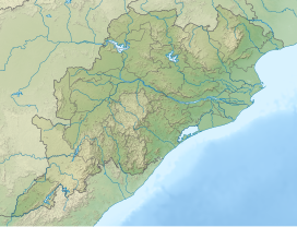
| Garhjat Range | |
|---|---|
 View of the range in Binikeyee, Athmallik, Angul district | |
| Highest point | |
| Peak | Malayagiri |
| Elevation | 1,187 m (3,894 ft) |
| Dimensions | |
| Length | 382 km (237 mi) SW-NE |
| Width | 100 km (62 mi) |
| Geography | |
| Country | India |
| States | Jharkhand, Chhattisgarh, Odisha |
| Rivers | Brahmani, Mahanadi, Baitarani and Subarnarekha |
| Range coordinates | 21°22′N 85°16′E / 21.367°N 85.267°E |

The Garhjat Hills is a mountain range formed by a series low-lying hills, plateaux, ridges and meadows that stretch into Odisha from the Utkal Plains in the Chotanagpur region of Jharkhand and the Chhattisgarh Plains. The range, also known as the Odisha Highlands, runs in a north east to south west direction for about 382 km along the Odisha coast, covering 76,800 km2 (29,700 sq mi).[1]
The range rises abruptly and steeply in the east and slopes gently to a dissected plateau in the west running from north-east (Mayurbhanj) to south-west (Malkangiri). The whole area is also marked by intermontane basins which cut across the region in a number of broad and narrow river valleys and flood plains. The average height of the range is about 900 metres above mean sea level.
