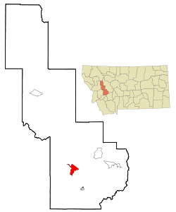
Garrison, Montana | |
|---|---|
 Location of Garrison, Montana | |
| Coordinates: 46°32′15″N 112°49′35″W / 46.53750°N 112.82639°W | |
| Country | United States |
| State | Montana |
| County | Powell |
| Area | |
• Total | 9.64 sq mi (24.96 km2) |
| • Land | 9.63 sq mi (24.95 km2) |
| • Water | 0.00 sq mi (0.01 km2) |
| Elevation | 4,374 ft (1,333 m) |
| Population (2020) | |
• Total | 115 |
| • Density | 11.94/sq mi (4.61/km2) |
| Time zone | UTC-7 (Mountain (MST)) |
| • Summer (DST) | UTC-6 (MDT) |
| ZIP code | 59731 |
| Area code | 406 |
| FIPS code | 30-30175 |
| GNIS feature ID | 0771720[2] |
Garrison is a census-designated place (CDP) in Powell County, Montana, United States. The population was 112 at the 2000 census.
The traditional Salish name for the area that was later named Garrison Junction is snx̣ʷq̓pusaqs. Groups would split up here, with some going towards Helena, others towards Butte.[3]
- ^ "ArcGIS REST Services Directory". United States Census Bureau. Retrieved September 5, 2022.
- ^ a b U.S. Geological Survey Geographic Names Information System: Garrison, Montana
- ^ Pete, Tachini. Seliš Nyoʻnuntn = Medicine for the Salish Language: English to Salish Translation Dictionary. 2nd ed. Pablo, MT : Lincoln, NE: Salish Kootenai College Press ; Distributed by University of Nebraska Press, 2010.