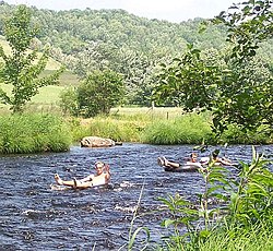
| Gaspereau River | |
|---|---|
 Tubing on the Gaspereau River | |
 | |
| Location | |
| Country | Canada |
| Province | Nova Scotia |
| Physical characteristics | |
| Source | |
| • location | Gaspereau Lake |
| Mouth | |
• location | Minas Basin |
• elevation | sea level |
| Length | 24.5 km (15.2 mi) |
| Basin size | 1,375 km (854 mi) |
The Gaspereau River is a river in Kings County, Nova Scotia, Canada.
It has a length of approximately 24 km from its source at Gaspereau Lake on the South Mountain south of Kentville to its mouth at Hortonville on the Minas Basin. The lower portion of the river is tidal for 6.5 km until Melanson and there are extensive tidal marshes in the lower reaches. The upper 16 km runs swiftly over gravel beds, boulders and bedrock, except for several dammed sections which form narrow and deep channels. Damming for Hydroelectric generation has resulted in twelve major lakes being connected to the river creating a watershed of 1,375 square kilometres.[1] A major tributary is the Black River which joins the Gaspeareau at White Rock. The Black River once flowed further north into the Cornwallis River but connected to the Gaspereau through a natural erosion process known as river capture.[2]
- ^ Natural History of Nova Scotia, Volume 1, Chapter T8 "Freshwater Hydrology", Nova Scotia Museum (1996) p.152
- ^ A Natural History of Kings County, Blomidon Naturalist Society, p. 77-78