This article relies largely or entirely on a single source. (June 2019) |
Gauriganj | |
|---|---|
Municipal corporation | |
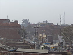
 Gauriganj skyline | |
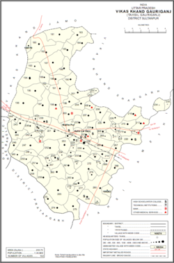
 Map of Gauriganj CD block | |
| Coordinates: 26°12′22″N 81°41′24″E / 26.206°N 81.690°E | |
| Country | |
| State | Uttar Pradesh |
| Division | Ayodhya |
| District | Amethi |
| Government | |
| • Type | Municipal Council |
| • Body | Gauriganj Municipal Council |
| • Municipal Chairperson | Reshmi[1][2] (BJP) |
| • MLA | Rakesh Pratap Singh (SP)[3] |
| Elevation | 104 m (341 ft) |
| Population (2011)[4] | |
| • Total | 390,935 |
| • Density | 855/km2 (2,210/sq mi) |
| Language | |
| • Official | Hindi[5] |
| • Additional official | Urdu[5] |
| Time zone | UTC+5:30 (Indian Standard Time) |
| Postal code | 227409 |
| Telephone code | 05-368 |
| Sex ratio | 904:1000 ♂/♀ |
| Vehicle Registration | UP-36 |
Gauriganj is a city, municipal corporation, tehsil and administrative headquarters of Amethi district in Ayodhya division, Uttar Pradesh, India.[4] It is situated about 126 km from the state capital Lucknow. Before July 2010, it was part of Sultanpur district. After that Gauriganj, Amethi, Jais, Jagdispur and Salon formed a new district Chhatrapati Sahuji Maharaj Nagar, later named Gauriganj and now Amethi. Gauriganj is connected with State Highway 34 and National Highway 128.
- ^ "2023 UP Municipal Election results". ECI Uttar Pradesh. Retrieved 22 May 2023.
- ^ "2023 UP Municipal Election detailed results". ECI Uttar Pradesh. Retrieved 12 July 2023.
- ^ "Uttar Pradesh Legislative Assembly (UPLA): Member info". www.upvidhansabhaproceedings.gov.in. Retrieved 14 October 2019.
- ^ a b Cite error: The named reference
Census2011Govwas invoked but never defined (see the help page). - ^ a b "52nd Report of the Commissioner for Linguistic Minorities in India" (PDF). nclm.nic.in. Ministry of Minority Affairs. Archived from the original (PDF) on 25 May 2017. Retrieved 11 January 2018.

