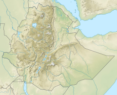
| Genfel | |
|---|---|
 | |
Genfel River in Tigray Region | |
| Location | |
| Country | Ethiopia |
| Region | Tigray Region |
| Districts (woreda) | Kilte Awula’ilo, Atsbi Wenberta |
| Physical characteristics | |
| Source | |
| • location | North of Wukro |
| • elevation | 2,253 m (7,392 ft) |
| Mouth | Giba River |
• location | Shugu'a Shugu'i |
• coordinates | 13°38′49″N 39°24′54″E / 13.647°N 39.415°E |
• elevation | 1,770 m (5,810 ft) |
| Length | 51 km (32 mi) |
| Basin size | 969 km2 (374 sq mi) |
| Width | |
| • average | 30 m (98 ft) |
| Discharge | |
| • location | Near the outlet at Shugu'a Shugu'i[1] |
| • maximum | 300 m3/s (11,000 cu ft/s) |
| Basin features | |
| River system | Permanent river |
| Landmarks | Wukro town |
| Waterbodies | Gereb May Zib'i, La’ilay Wukro and future Lake Giba reservoirs |
| Waterfalls | Rapids |
| Bridges | Wukro |
| Topography | Mountains and deep gorges |
The Genfel is a river of northern Ethiopia. Rising on the foot of the Atsbi horst at 2,253 metres above sea level, it flows southwestward to Giba River which empties finally in the Tekezé River.[2] Future Lake Giba will occupy the plain where Sulluh, Genfel and Agula'i Rivers meet.

- ^ Amanuel Zenebe, and colleagues (2013). "Spatial and temporal variability of river flows in the degraded semi-arid tropical mountains of northern Ethiopia". Zeitschrift für Geomorphologie. 57 (2): 143–169. Bibcode:2013ZGm....57..143Z. doi:10.1127/0372-8854/2012/0080.
- ^ Jacob, M. and colleagues (2019). Geo-trekking map of Dogu'a Tembien (1:50,000). In: Geo-trekking in Ethiopia's Tropical Mountains - The Dogu'a Tembien District. SpringerNature. ISBN 978-3-030-04954-6.
