Nickname: Nature Isle of the Caribbean | |
|---|---|
 Map of Dominica | |
 | |
| Geography | |
| Location | Caribbean Sea |
| Coordinates | 15°25′N 61°20′W / 15.417°N 61.333°W |
| Archipelago | Windward Islands |
| Area | 751 km2 (290 sq mi) |
| Length | 47 km (29.2 mi) |
| Width | 29 km (18 mi) |
| Coastline | 148 km (92 mi) |
| Highest elevation | 1,447 m (4747 ft) |
| Highest point | Morne Diablotins |
| Administration | |
| Largest settlement | Roseau (pop. 14,847) |
| Demographics | |
| Population | 71,727 (2003) |
| Pop. density | 95.51/km2 (247.37/sq mi) |
| Ethnic groups | Black 90%, Mulatto, 8 % Carib-Amerindian 2% |
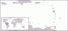
Dominica is an island in the Caribbean Sea, located about halfway between the French islands of Guadeloupe (to the north) and Martinique (to the south). Its coordinates are 15 25 N, 61 20 W. It is known as "The Nature Island of the Caribbean"[1] due to its spectacular, lush, and varied flora and fauna, which is protected by an extensive natural park system. It is the fourth largest island in the Eastern Caribbean with a population of people mainly of African descent.
The lowest point in the country is at sea level along the coast, and the highest is Morne Diablotins (1,447 m or 4,747 ft). The extreme southwestern coast of the island includes a large collapsed submarine caldera. Portions of the exposed rim of this caldera form the southwestern tip of the island at Scotts Head. Natural resources include farming, hydropower and timber.
Geographically, Dominica is distinctive in many ways.[1] The country has one of the most rugged landscapes in the Caribbean, covered by a largely unexploited, multi-layered rain forest.[1] It is also among the Earth's most rain-drenched lands, and the water runoff forms cascading rivers and natural pools.[1] The island, home to rare species of wildlife, is considered by many as a beautiful, unspoiled tropical preserve.[1] According to a popular West Indian belief, Dominica is the only New World territory that Columbus would still recognize.[1]
Dominica is the largest and most northerly of the Windward Islands. The island faces the Atlantic Ocean to the east and the Caribbean Sea to the west.[1] Its nearest neighbours are the French islands of Guadeloupe, some 48 kilometres (30 mi) north, and Martinique, about 40 kilometres (25 mi) south.[1] Oblong-shaped and slightly smaller than New York City, Dominica is 750 square kilometres (290 sq mi) in area, 47 kilometres (29 mi) in length, and 29 kilometres (18 mi) in width.[1] Roseau, the nation's capital and major port, is favourably situated on the sheltered, southwestern coast.[1]
- ^ a b c d e f g h i j
 This article incorporates text from this source, which is in the public domain: Martin, Atherton (1987). "Dominica: Geography". In Meditz, Sandra W.; Hanratty, Dennis M. (eds.). Islands of the Commonwealth Caribbean: a regional study. Washington, D.C.: Federal Research Division, Library of Congress. pp. 267–270. OCLC 49361510.