Native name: Guåhan | |
|---|---|
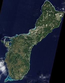
 A satellite image of Guam | |
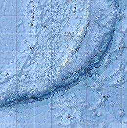
 Bathymetric map of the vicinity of Guam, including the Mariana Trench and East Mariana Ridge | |
| Geography | |
| Location | Pacific Ocean |
| Coordinates | 13°26′31″N 144°46′35″E / 13.44194°N 144.77639°E |
| Archipelago | Mariana Islands |
| Area | 544 km2 (210 sq mi) |
| Length | 51 km (31.7 mi) |
| Width | 15 km (9.3 mi) |
| Coastline | 125.5 km (77.98 mi) |
| Highest elevation | 406 m (1332 ft) |
| Highest point | Mount Lamlam |
| Administration | |
| Territory | Guam |
| Largest settlement | Dededo (pop. 46,000) |
| Demographics | |
| Population | 167,358 [1] (July 2017 est.) |
| Pop. density | 320.44/km2 (829.94/sq mi) |
| Ethnic groups | Native Chamorros (57%), Filipino (25.5%), White (10%), Chinese, Japanese and Korean ancestry |
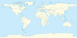
Guam is a U.S. territory in the western Pacific Ocean, at the boundary of the Philippine Sea. It is the southernmost and largest member of the Mariana Islands archipelago, which is itself the northernmost group of islands in Micronesia. The closest political entity is the Commonwealth of the Northern Mariana Islands (CNMI), another U.S. territory. Guam shares maritime boundaries with CNMI to the north and the Federated States of Micronesia to the south. It is located approximately one quarter of the way from the Philippines to Hawaii. Its location and size make it strategically important. It is the only island with both a protected harbor and land for multiple airports between Asia and Hawaii, on an east–west axis, and between Papua New Guinea and Japan, on a north–south axis.[2]
The island is a result of the volcanic activity created by subduction of the Pacific Plate under the Philippine Sea Plate at the nearby Mariana Trench, which runs from the east of Guam to the southwest. Volcanic eruptions established the base of the island in the Eocene, roughly 56 to 33.9 million years ago (mya). The north of Guam is a result of this base being covered with layers of coral reef, turning into limestone, and then being thrust by tectonic activity to create a plateau. The rugged south of the island is a result of more recent volcanic activity. Cocos Island off the southern tip of Guam is the largest of the many small islets along the coastline.
Politically, Guam is divided into 19 villages. The majority of the population lives on the coralline limestone plateaus of the north, with political and economic activity centered in the central and northern regions. The rugged geography of the south largely limits settlement to rural coastal areas. The western coast is leeward of the trade winds and is the location of Apra Harbor, the capitol Hagåtña, and the tourist center of Tumon. The U.S. Defense Department owns about 29% of the island,[3] under the management of Joint Region Marianas.
- ^ The World Factbook: Guam Archived 2021-01-26 at the Wayback Machine CIA. Retrieved on October 18, 2017.
- ^ Rogers, Robert F. (October 8, 2020). "Guam's Strategic Value". Guampedia. Archived from the original on March 10, 2021. Retrieved March 14, 2021.
- ^ "Guam: Small But Important Piece of US Territory in Pacific | Voice of America - English". VOA News. August 9, 2017. Archived from the original on 10 March 2021. Retrieved 14 March 2021.

