 | |
| Continent | Africa |
|---|---|
| Region | Southern Africa |
| Coordinates | 22°00′S 17°00′E / 22.000°S 17.000°E |
| Area | Ranked 34th |
| • Total | 825,615 km2 (318,772 sq mi) |
| • Land | 99.88% |
| • Water | 0.12% |
| Coastline | 1,572 km (977 mi) |
| Borders | Total: 4,220 km (2,620 mi) |
| Highest point | Königstein 2,573 metres (8,442 ft) |
| Lowest point | Atlantic Ocean 0 metres (0 ft) |
| Longest river | Fish River 650 km (400 mi) |
| Largest lake | Lake Guinas 0.66 ha (1.6 acres) |
| Exclusive economic zone | 564,748 km2 (218,050 sq mi) |


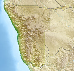
At 824,292 km2 (318,261 sq mi), Namibia is the world's thirty-fourth largest country. After Mongolia, Namibia is the second least densely populated country in the world (2.7 inhabitants per square kilometre (7.0/sq mi)). Namibia got its name from the Namib desert that stretches along the coast of the Atlantic. It is also known for its wildlife.