

With a total area of 121,590 square miles (314,900 km2),[1] New Mexico is the fifth-largest state, after Alaska, Texas, California, and Montana. Its eastern border lies along 103°W longitude with the state of Oklahoma, and 2.2 miles (3.5 kilometres) west of 103°W longitude with Texas (due to a 19th-century surveying error).[2][3] On the southern border, Texas makes up the eastern two-thirds, while the Mexican states of Chihuahua and Sonora make up the western third, with Chihuahua making up about 90% of that. The western border with Arizona runs along the 109° 03'W longitude.[4] The southwestern corner of the state is known as the Bootheel. The 37°N parallel forms the northern boundary with Colorado. The states of New Mexico, Colorado, Arizona, and Utah come together at the Four Corners in New Mexico's northwestern corner. Its surface water area is about 292 square miles (760 km2).[1]
Despite its popular depiction as mostly arid desert, New Mexico has one of the most diverse landscapes of any U.S. state, ranging from wide, auburn-colored deserts and verdant grasslands, to broken mesas and high, snow-capped peaks.[5] Close to a third of the state is covered in timberland, with heavily forested mountain wildernesses dominating the north. The Sangre de Cristo Mountains, the southernmost part of the Rocky Mountains, run roughly north–south along the east side of the Rio Grande, in the rugged, pastoral north. The Great Plains extend into the eastern third of the state, most notably the Llano Estacado ("Staked Plain"), whose westernmost boundary is marked by the Mescalero Ridge escarpment. The northwestern quadrant of New Mexico is dominated by the Colorado Plateau, characterized by unique volcanic formations, dry grasslands and shrublands, open pinyon-juniper woodland, and mountain forests.[6] The Chihuahuan Desert, which is the largest in North America, extends through the south.
Over four–fifths of New Mexico is higher than 4,000 feet (1,200 meters) above sea level. The average elevation ranges from up to 8,000 feet (2,400 meters) above sea level in the northwest, to less than 4,000 feet in the southeast.[5] The highest point is Wheeler Peak at over 13,160 feet (4,010 meters) in the Sangre de Cristo Mountains, while the lowest is the Red Bluff Reservoir at around 2,840 feet (870 meters), in the southeastern corner of the state.
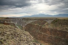
In addition to the Rio Grande, which is tied for the fourth-longest river in the U.S., New Mexico has four other major river systems: the Pecos, Canadian, San Juan, and Gila.[7] Nearly bisecting New Mexico from north to south, the Rio Grande has played an influential role in the region's history; its fertile floodplain has supported human habitation since prehistoric times, and European settlers initially lived exclusively in its valleys and along its tributaries.[5] The Pecos, which flows roughly parallel to the Rio Grande at its east, was a popular route for explorers, as was the Canadian River, which rises in the mountainous north and flows east across the arid plains. The San Juan and Gila lie west of the Continental Divide, in the northwest and southwest, respectively. With the exception of the Gila, all major rivers are dammed in New Mexico and provide a major water source for irrigation and flood control.
Aside from its rivers, New Mexico has few sizeable natural bodies of water; there are several artificial lakes and reservoirs, the largest being Elephant Butte Reservoir, which was created by the damming of the Rio Grande. At its height in the early 20th century, the reservoir was the largest man-made lake in the world.[8]
- ^ a b "United States Summary: 2010 – Population and Housing Unit Counts" (PDF). U.S. Census Bureau. September 2012. p. 41. Retrieved March 14, 2020.
- ^ "Archived copy" (PDF). Archived from the original (PDF) on April 24, 2015. Retrieved February 8, 2018.
{{cite web}}: CS1 maint: archived copy as title (link) - ^ "MAPS". NM Partnership. Archived from the original on September 14, 2014. Retrieved September 17, 2014.
- ^ "Climate of New Mexico". New Mexico State University. Archived from the original on July 8, 2004. Retrieved March 20, 2010.
- ^ a b c "New Mexico | Flag, Facts, Maps, & Points of Interest". Encyclopedia Britannica. Retrieved 2021-08-03.
- ^ "Colorado Plateau shrublands | Ecoregions | WWF". World Wildlife Fund. Retrieved 2021-08-03.
- ^ "Rivers of the World". USGS. Archived from the original on March 5, 2009. Retrieved May 22, 2010.
- ^ "Bureau of Reclamation". 2006-09-26. Archived from the original on September 26, 2006. Retrieved 2021-08-03.