This article needs additional citations for verification. (November 2024) |

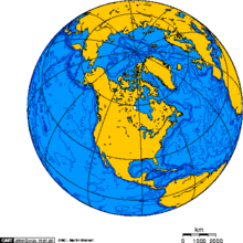
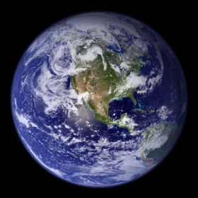
North America is the third largest continent, and is also a portion of the third largest supercontinent if North and South America are combined into the Americas and Africa, Europe, and Asia are considered to be part of one supercontinent called Afro-Eurasia. With an estimated population of 580 million and an area of 24,709,000 km2 (9,540,000 mi2), the northernmost of the two continents of the Western Hemisphere[1] is bounded by the Pacific Ocean on the west; the Atlantic Ocean on the east; the Caribbean Sea on the south; and the Arctic Ocean on the north.
The northern half of North America is sparsely populated and covered mostly by Canada, except for the northeastern portion, which is occupied by Greenland, and the northwestern portion, which is occupied by Alaska, the largest state of the United States. The central and southern portions of the continent are occupied by the contiguous United States, Mexico, and numerous smaller states in Central America and in the Caribbean.
The continent is delimited on the southeast by most geographers at the Darién watershed along the Colombia-Panama border, placing all of Panama within North America.[2][3][4] Alternatively, a less common view would end North America at the man-made Panama Canal. Islands generally associated with North America include Greenland, the world's largest island, and archipelagos and islands in the Caribbean. The terminology of the Americas is complex, but "Anglo-America" can describe Canada and the U.S., while "Latin America" comprises Mexico and the countries of Central America and the Caribbean, as well as the entire continent of South America.
Natural features of North America include the northern portion of the American Cordillera, represented by the geologically new Rocky Mountains in the west; and the considerably older Appalachian Mountains to the east. The north hosts an abundance of glacial lakes formed during the last glacial period, including the Great Lakes. North America's major continental divide is the Great Divide, which runs north and south down through Rocky Mountains. The major watersheds draining to the include the Mississippi/Missouri and Rio Grande draining into the Gulf of Mexico (part of the Atlantic Ocean), and the St. Lawrence draining into the Atlantic. The Colorado, Colombia, and Yukon Rivers drain west to the Pacific Ocean.
Climate is determined to a large extent by the latitude, ranging from Arctic cold in the north to tropical heat in the south. There are steppes (known as "prairies") in the central and western portions, and deserts in the Southwestern United States of Arizona, Colorado, California, Nevada, New Mexico, Utah, and Texas; along with the Mexican states of Baja California, Baja California Sur, Sonora, Chihuahua, Coahuila, Nuevo Leon and Tamaulipas.

- ^ "Geographic Guide - Images of North America". Retrieved October 11, 2006.
- ^ "Americas" Standard Country and Area Codes Classifications (M49), United Nations Statistics Division
- ^ "North America" Archived October 21, 2006, at the Wayback Machine Atlas of Canada
- ^ North America Atlas National Geographic