 | |
| Continent | North America |
|---|---|
| Region | Caribbean |
| Coordinates | 9°00′N 80°00′W / 9.000°N 80.000°W |
| Area | Ranked 116th |
| • Total | 75,417 km2 (29,119 sq mi) |
| • Land | 98.57% |
| • Water | 1.43% |
| Coastline | 2,490 km (1,550 mi) |
| Borders | Total border: 555 km (345 mi) |
| Highest point | Volcán Barú 3,475 metres (11,401 ft) |
| Lowest point | Pacific Ocean 0 metres (0 ft) |
| Longest river | Chucunaque River 231 km (144 mi) |
| Largest lake | Gatun Lake 425 km2 (164 sq mi) |
| Exclusive economic zone | 335,646 km2 (129,594 sq mi) |

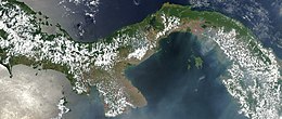
Panama is a country located in Caribbean, bordering both the Caribbean Sea and the Pacific Ocean, between Colombia and Costa Rica. Panama is located on the narrow and low Isthmus of Panama.
This S-shaped isthmus is situated between 7° and 10° north latitude and 77° and 83° west longitude. Panama encompasses approximately 75,417 km2 (29,119 sq mi). It is 772 km (480 mi) long, and between 60 and 177 kilometers (37 and 110 miles) wide.