 | |
| Continent | Africa |
|---|---|
| Region | East Africa |
| Coordinates | 6°00′S 35°00′E / 6.000°S 35.000°E |
| Area | Ranked 30th |
| • Total | 945,087 km2 (364,900 sq mi) |
| • Land | 93.51% |
| • Water | 6.49% |
| Coastline | 1,424 km (885 mi) |
| Borders | 4,161 km (2,586 mi) |
| Highest point | Mount Kilimanjaro 5,895 metres (19,341 ft) |
| Lowest point | Indian Ocean 0 metres (0 ft) |
| Longest river | Rufiji River 600 km (370 mi) |
| Largest lake | Lake Victoria 59,947 km2 (23,146 sq mi) |
| Exclusive economic zone | 241,888 km2 (93,393 sq mi) |


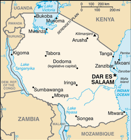
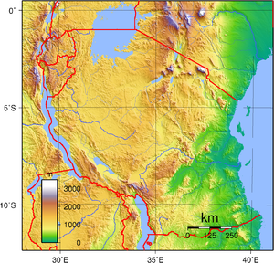
Tanzania comprises many lakes, national parks, and Africa's highest point, Mount Kilimanjaro (5,895 m or 19,341 ft). Northeast Tanzania is mountainous, while the central area is part of a large plateau covered in grasslands. The country also contains the southern portion of Lake Victoria on its northern border with Uganda and Kenya.
Administratively, Tanzania is divided into 31 regions,[1] with twenty-five on the mainland, three on Unguja (known informally as Zanzibar Island), and two on Pemba Island.
- ^ "Regions of Tanzania". Statoids. Retrieved 6 December 2014.