 | |
| Continent | Asia |
|---|---|
| Region | Middle East |
| Coordinates | 24°N 54°E / 24°N 54°E |
| Area | Ranked 114th |
| • Total | 83,600 km2 (32,300 sq mi) |
| • Land | 100% |
| • Water | 0% |
| Coastline | 1,318 km (819 mi) |
| Borders | total: 867 km (539 mi) |
| Highest point | Jabal ar Rahrah 1,691 m (5,548 ft) [1] |
| Lowest point | Persian Gulf 0 m |
| Longest river | None |
| Largest lake | Lake Zakher |
| Climate | arid; mild, pleasant winters; very hot, humid summers |
| Terrain | mountainous and barren desert covered with loose sand and gravel |
| Natural resources | petroleum, natural gas, marine resources |
| Natural hazards | haze, dust storms, sandstorms common |
| Environmental issues | limited natural freshwater resources are increasing dependence on large-scale desalination facilities |
| Exclusive economic zone | 58,218 km2 (22,478 sq mi) |
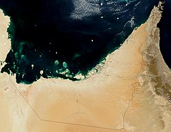
The United Arab Emirates is situated in the Middle East and West Asia, bordering the Gulf of Oman and the Persian Gulf, between Oman and Saudi Arabia; it is at a strategic location along the northern approaches to the Strait of Hormuz, a vital transit point for world crude oil.[2] The UAE lies between 22°50′ and 26° north latitude and between 51° and 56°25′ east longitude.[3] It shares a 19 km (12 mi) border with Qatar on the northwest, a 530 km (330 mi) border with Saudi Arabia on the west, south, and southeast, and a 450 km (280 mi) border with Oman on the southeast and northeast.[3]
The land border with Qatar in the Khawr al Udayd area is a source of long-running dispute[3] (in fact, whether it even shares a land border with Qatar is in dispute). The total area of the UAE is approximately 83,600 square kilometres (32,300 square miles).[2] The country's exact size is unknown because of disputed claims to several islands in the Persian Gulf, because of the lack of precise information on the size of many of these islands, and because most of its land boundaries, especially with Saudi Arabia, remain undemarcated.[3] The largest emirate, Abu Dhabi, accounts for 87 percent of the UAE's total area (72,732 km2 (28,082 sq mi)).[3] The smallest emirate, Ajman, encompasses only 259 km2 (100 sq mi).[3]
- ^ "Jabal ar Rahrah - United Arab Emirates | peakery".
- ^ a b "United Arab Emirates". The World Factbook. Central Intelligence Agency. August 23, 2021. Retrieved September 1, 2021.
 This article incorporates text from this source, which is in the public domain.
- ^ a b c d e f Hooglund, Eric; Toth, Anthony (1994). "United Arab Emirates: Geography". In Metz, Helen Chapin (ed.). Persian Gulf states: country studies (3rd ed.). Washington, D.C.: Federal Research Division, Library of Congress. pp. 204–208. ISBN 0-8444-0793-3. OCLC 29548413.
 This article incorporates text from this source, which is in the public domain.
{{cite encyclopedia}}: CS1 maint: postscript (link)