| Georges River Tucoerah River[1] | |
|---|---|
 | |
NASA satellite view of Greater Metropolitan Sydney, with the location of the mouth of the Georges River, as marked | |
| Etymology | In honour of King George III[2] |
| Location | |
| Country | Australia |
| State | New South Wales |
| Region | Greater Metropolitan Sydney |
| LGAs | Bayside, Campbelltown, Canterbury-Bankstown, Fairfield, Georges River, Liverpool, Sutherland, Wollondilly |
| Physical characteristics | |
| Source | Upland swamps, O'Hares Creek |
| • location | east of Appin in Macarthur |
| • coordinates | 34°15′00″S 150°49′48″E / 34.25000°S 150.83000°E |
| • elevation | 350 m (1,150 ft) |
| Mouth | Botany Bay |
• location | Taren Point/Sans Souci |
• coordinates | 34°0′35.994″S 151°7′47.6394″E / 34.00999833°S 151.129899833°E |
| Length | 96 km (60 mi) |
| Basin size | 930.9 km2 (359.4 sq mi) |
| Basin features | |
| Tributaries | |
| • left | Bunbury Curran Creek, Cabramatta Creek, Lennox River (proposed), Prospect Creek, Salt Pan Creek, Boggywell Creek |
| Lakes and reservoirs | Chipping Norton Lake |
| [3][4] | |
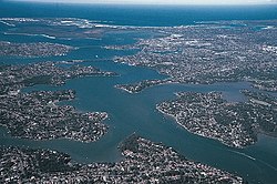
The Georges River, also known as Tucoerah River,[1] is an intermediate tide-dominated drowned valley estuary,[5] that is located in Sydney, Australia. The Georges River is located south and south-west from the Sydney central business district, with the mouth of the river being at Botany Bay.
The river travels for approximately 96 kilometres (60 mi) in a north and then easterly direction to its mouth at Botany Bay, about 5 kilometres (3.1 mi) from the Tasman Sea. The Georges River is the main tributary of Botany Bay; with the Cooks River being a secondary tributary.
The total catchment area of the river is approximately 930.9 square kilometres (359.4 sq mi) and the area surrounding the river is managed by various local government authorities and NSW Government agencies across Sydney.
The land adjacent to the Georges River was occupied for many thousands of years by the Tharawal and Eora peoples. They used the river as an important source of food and a place for trade.
- ^ a b "Georges River". Geographical Names Register (GNR) of NSW. Geographical Names Board of New South Wales. Retrieved 4 January 2013.
- ^ Cite error: The named reference
Pollonwas invoked but never defined (see the help page). - ^ "Georges River". Estuaries of NSW. Office of Environment & Heritage. 26 April 2012. Retrieved 4 January 2013.
- ^ "Georges River information page". Campbelltown City Council. Archived from the original on 2008-07-30.
- ^ Roy, P. S.; Williams, R. J.; Jones, A. R.; Yassini, I.; et al. (2001). "Structure and Function of South-east Australian Estuaries". Estuarine, Coastal and Shelf Science. 53 (3): 351–384. Bibcode:2001ECSS...53..351R. doi:10.1006/ecss.2001.0796.
