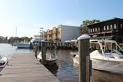
Georgetown, South Carolina | |
|---|---|
 Georgetown harbor | |
 Location in Georgetown County and the state of South Carolina. | |
| Coordinates: 33°22′3″N 79°17′38″W / 33.36750°N 79.29389°W | |
| Country | United States |
| State | South Carolina |
| County | Georgetown |
| Incorporated | 1729 |
| Government | |
| • Mayor | Carol Jayroe |
| Area | |
| • Total | 7.59 sq mi (19.65 km2) |
| • Land | 6.99 sq mi (18.11 km2) |
| • Water | 0.59 sq mi (1.54 km2) |
| Elevation | 18 ft (5 m) |
| Population | |
| • Total | 8,403 |
| • Density | 1,201.80/sq mi (464.02/km2) |
| Time zone | UTC−5 (EST) |
| • Summer (DST) | UTC−4 (EDT) |
| ZIP codes | 29440, 29442 |
| Area code(s) | 843, 854 |
| FIPS code | 45-28870[3] |
| GNIS feature ID | 1247888[4] |
| Website | cityofgeorgetownsc |


Georgetown is the third oldest city in the U.S. state of South Carolina and the county seat of Georgetown County, in the Lowcountry.[5] As of the 2010 census it had a population of 9,163.[6] Located on Winyah Bay at the confluence of the Black, Great Pee Dee, Waccamaw, and Sampit rivers, Georgetown is the second largest seaport in South Carolina, handling over 960,000 tons of materials a year, while Charleston is the largest.
Beginning in the colonial era, Georgetown was the commercial center of an indigo- and rice-producing area. Rice replaced indigo as the chief commodity crop in the antebellum area. Later the timber industry became important here. [citation needed]
- ^ "ArcGIS REST Services Directory". United States Census Bureau. Retrieved October 15, 2022.
- ^ Cite error: The named reference
USCensusDecennial2020CenPopScriptOnlywas invoked but never defined (see the help page). - ^ "U.S. Census website". United States Census Bureau. Retrieved January 31, 2008.
- ^ "US Board on Geographic Names". United States Geological Survey. October 25, 2007. Retrieved January 31, 2008.
- ^ "Find a County". National Association of Counties. Archived from the original on May 31, 2011. Retrieved June 7, 2011.
- ^ "Geographic Identifiers: 2010 Demographic Profile Data (G001): Georgetown city, South Carolina". American Factfinder. U.S. Census Bureau. Retrieved February 8, 2017.[dead link]
