Georgia State Route 112 highlighted in red | ||||
| Route information | ||||
| Maintained by GDOT | ||||
| Length | 189.84 mi[1] (305.52 km) | |||
| Major junctions | ||||
| South end | ||||
| ||||
| North end | ||||
| Location | ||||
| Country | United States | |||
| State | Georgia | |||
| Counties | Grady, Mitchell, Worth, Turner, Wilcox, Pulaski, Bleckley, Twiggs, Wilkinson, Baldwin | |||
| Highway system | ||||
| ||||
| ||||
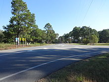
State Route 112 (SR 112) is a 189.84-mile-long (305.52 km) state highway that travels in a generally southwest-to-northeast orientation in the southwestern and central parts of the U.S. state of Georgia. It passes through portions of Grady, Mitchell, Worth, Turner, Wilcox, Pulaski, Bleckley, Twiggs, Wilkinson, and Baldwin counties, and connects the Cairo and Milledgeville areas of the state.

- ^ "Overview map of SR 112" (Map). Google Maps. Retrieved July 16, 2013.

