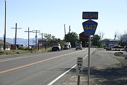
Gerlach, Nevada | |
|---|---|
 | |
 Location of Gerlach, Nevada | |
| Coordinates: 40°39′6″N 119°21′19″W / 40.65167°N 119.35528°W[1] | |
| Country | United States |
| State | Nevada |
| Area | |
| • Total | 3.13 sq mi (8.09 km2) |
| • Land | 3.13 sq mi (8.09 km2) |
| • Water | 0.00 sq mi (0.00 km2) |
| Elevation | 3,944 ft (1,202 m) |
| Population (2020) | |
| • Total | 130 |
| • Density | 41.60/sq mi (16.06/km2) |
| Time zone | UTC−8 (Pacific (PST)) |
| • Summer (DST) | UTC−7 (PDT) |
| ZIP code | 89412 |
| Area code | 775 |
| FIPS code | 32-27300 |
| GNIS feature ID | 845471[1] |
| Website | |
| Reference no. | 152 |
Gerlach, Nevada is a census-designated place (CDP) in Washoe County, Nevada, United States.[1] The population was 130 at the 2020 census.[3] It is part of the Reno–Sparks Metropolitan Statistical Area. Prior to 2010, Gerlach was part of the Gerlach–Empire census-designated place. The town of Empire is now a separate CDP. The next nearest town, Nixon, is 60 miles (100 km) to the south on a reservation owned by the Pyramid Lake Paiute Tribe. The Fly Geyser is located near Gerlach.
- ^ a b c d U.S. Geological Survey Geographic Names Information System: Gerlach, Nevada
- ^ "ArcGIS REST Services Directory". United States Census Bureau. Retrieved September 19, 2022.
- ^ "Explore Census Data". data.census.gov. Retrieved September 5, 2023.

