Ghoriwala
غوري والا غوریوالہ | |
|---|---|
Town and union council | |
| Ghoriwala | |
|
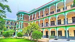
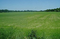
Top left to right: Government High School Ghoriwala, Government Degree College Ghoriwala, RHC Hospital Ghoriwala, Jumeirah Housing Society, Kacha Bachak Road Intersection, and Mughal Khel Playground. | |
| Coordinates: 32°54′20″N 70°43′40″E / 32.90556°N 70.72778°E | |
| Country | |
| Province | |
| District | Bannu |
| Tehsil | Bannu |
| Named for | Muhammad of Ghor |
| Government | |
| • Type | Union Council |
| • Nazim | Umar Khayyam Khan |
| Elevation | 295 m (968 ft) |
| Population | |
| • Total | 154,773 |
| Time zone | UTC+5 (PST) |
| Postal Code of Pakistan | 28330 |
| Area code | 928 |
| Languages | Pashto |
| Website | bannu |
Ghoriwala (Pashto: غوري واله, romanized: ġwary wala, pronounced [/ɣoˈri wɑlə/] ; Urdu: غوریوالہ, romanized: Ghuriwala, pronounced [/ɣoːriː wɑːlə/] ) also called Ghariwola (Pashto: غاريوله, romanized: Gariwola, pronounced [/ɣɑːrjoːla/] )[2] is a town and union council in Bannu District of Khyber-Pakhtunkhwa.[3][4] Its history and name is sometimes linked with the famous Muslim King Sultan Muhammad Ghori. The area is mostly inhabited by Mughal Khel branch of Yousafzai Pashtuns.[5]
- ^ "POPULATION AND HOUSEHOLD DETAIL FROM BLOCK TO DISTRICT LEVEL" (PDF). www.pbs.gov.pk. 2022. p. 16. Archived (PDF) from the original on 2019-04-26. Retrieved 2023-01-14.
- ^ "Ghariwala Pronunciation". www.howtopronounce.com. Retrieved 2023-02-18.
- ^ Tehsils & Unions in the District of Bannu - Government of Pakistan
- ^ Location of Ghoriwala - Falling Rain Genomics
- ^ Gazetteer of the Bannu District: 1883. 1883. pp. P 58.


