| Gilson Mountains | |
|---|---|
 Southwest flank of Gilson Mountains, October 2005 | |
| Highest point | |
| Peak | Champlin Peak |
| Elevation | 7,504 ft (2,287 m) |
| Coordinates | 39°37′00″N 112°13′14″W / 39.616618°N 112.220499°W |
| Dimensions | |
| Length | 11 mi (18 km) SSW x NNE |
| Width | 8 mi (13 km) |
| Geography | |
| Country | United States |
| State | Utah |
| Regions | (southeast)-Great Basin (northeast)-Sevier Desert |
| County | Juab |
| Communities | Jericho Junction, Champlin, Soma, Uisco, Leamington and Mack |
| Borders on | Sevier Desert, Tintic Valley, East Tintic Mountains, Juab Valley, Sevier River and Canyon Mountains |
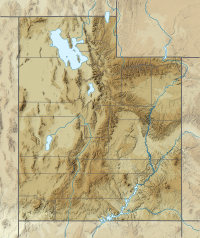
The Gilson Mountains are an 11-mile (18 km) long[1] almost circular, small mountain range adjacent the north terminus of the Canyon Mountains, (due-north trendline), located in far eastern Juab County, Utah, United States.[2][3][4]
- ^ Utah DeLorme Atlas & Gazetteer, pp. 34-35.
- ^ U.S. Geological Survey Geographic Names Information System: Gilson Mountains
- ^ Utah Road & Recreation Atlas (Map) (2002 ed.). 1:250000. Benchmark Maps. 2002. p. 58. § C6. ISBN 0-929591-74-7.
- ^ MyTopo Maps - Gilson Mountains, Juab County, UT, United States (Map). Trimble Navigation, Ltd. Retrieved 29 Jan 2017.
