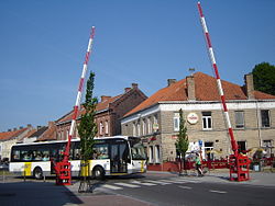
Gistel | |
|---|---|
City and municipality | |
 | |
| Coordinates: 51°09′N 02°58′E / 51.150°N 2.967°E | |
| Country | |
| Community | Flemish Community |
| Region | Flemish Region |
| Province | West Flanders |
| Arrondissement | Ostend |
| Government | |
| • Mayor | Gauthier Defreyne (VLD) |
| • Governing party/ies | VLD, N-VA, Vooruit |
| Area | |
• Total | 42.84 km2 (16.54 sq mi) |
| Population (2022-01-01)[1] | |
• Total | 12,106 |
| • Density | 280/km2 (730/sq mi) |
| Postal codes | 8470 |
| NIS code | 35005 |
| Area codes | 059 |
| Website | www.gistel.be |
Gistel (Dutch pronunciation: [ˈɣɪstəl]) is a city and municipality located in the Belgian province of West Flanders.
Following local government boundary reforms in 1971 and 1977, the municipality has comprised not only Gistel, but also the towns of Moere, Snaaskerke and Zevekote.
On January 1, 2006 the Gistel municipality had a total registered population of 11,125, of whom more than 8,000 were in Gistel itself. The total area is 42.25 km² which gives a population density of 263 inhabitants per km². The German town of Büdingen is its twin town.
- ^ "Bevolking per gemeente op 1 januari 2022". Statbel.


