| Glass House Mountains | |
|---|---|
 Aerial photo of Glass House Mountains township with the Glass House Mountains in the distance | |
| Highest point | |
| Peak | Mount Beerwah |
| Elevation | 556 m (1,824 ft) |
| Coordinates | 26°54′S 152°55′E / 26.900°S 152.917°E |
| Geography | |
| Country | Australia |
| State | Queensland |
| Region | South East Queensland |
| Geology | |
| Formed by | Volcanic plugs |
| Rock age | Tertiary |
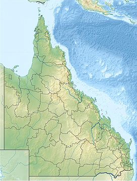
The Glass House Mountains are a cluster of thirteen hills that rise abruptly from the coastal plain on the Sunshine Coast, Queensland, Australia. The highest hill is Mount Beerwah at 556 metres above sea level, but the most identifiable of all the hills is Mount Tibrogargan which from certain angles bears a resemblance to a gorilla facing east towards the ocean. The Glass House Mountains are located near Beerburrum State Forest and Steve Irwin Way. From Brisbane, the mountains can be reached by following the Bruce Highway north and taking the Glass House Mountains tourist drive turn-off onto Steve Irwin Way. The trip is about one hour from Brisbane. The Volcanic peaks of the Glass House Mountains rise dramatically from the surrounding Sunshine Coast landscape. They were formed by intrusive plugs, remnants of volcanic activity that occurred 26–27 million years ago.[1] Molten rock filled small vents or intruded as bodies beneath the surface and solidified into land rocks. Millions of years of erosion have removed the surrounding exteriors of volcanic cores and softer sandstone rock.[citation needed]
On 17 May 1770, the hills were named the "Glass House Mountains" by explorer Lieutenant James Cook.[2] The peaks reminded him of the glass furnaces in his home county of Yorkshire.[3] The traditional names of the individual peaks are much older however.[citation needed] Matthew Flinders explored the area and climbed Mount Beerburrum after sailing along Pumicestone Passage in 1799. The Glass House Mountains National Landscape was added to the Australian National Heritage List on 3 August 2006.[4] In the land between the peaks, pineapple and poultry farming, as well as commercial forestry and quarrying are the main land uses.[5]
In 2009 as part of the Q150 celebrations, the Glass House Mountains was announced as one of the Q150 Icons of Queensland for its role as a "Natural attraction".[6]
- ^ Cohen, B. E.; Vasconcelos, P. M.; Knesel, K. M. (1 February 2007). "40Ar/39Ar constraints on the timing of Oligocene intraplate volcanism in southeast Queensland". Australian Journal of Earth Sciences. 54 (1): 105–125. Bibcode:2007AuJES..54..105C. doi:10.1080/08120090600981483. ISSN 0812-0099. S2CID 128834679.
- ^ "Glass House Mountains National Park and Beerburrum Forest Reserve 1 (entry 602494)". Queensland Heritage Register. Queensland Heritage Council. Retrieved 1 August 2014.
- ^ Environmental Protection Agency (Queensland) (2000). Heritage Trails of the Great South East. State of Queensland. p. 127. ISBN 978-0-7345-1008-2.
- ^ "National Heritage Places – Glass House Mountains National Landscape". Commonwealth of Australia. Archived from the original on 28 December 2014. Retrieved 29 November 2014.
- ^ Shilton, Peter (2005). Natural Areas of Queensland. Mount Gravatt, Queensland: Goldpress. pp. 160–162. ISBN 978-0-9758275-0-5.
- ^ Bligh, Anna (10 June 2009). "PREMIER UNVEILS QUEENSLAND'S 150 ICONS". Queensland Government. Archived from the original on 24 May 2017. Retrieved 24 May 2017.
