Glastonbury, Connecticut | |
|---|---|
Town | |
| Town of Glastonbury | |
 First Church of Christ | |
| Coordinates: 41°41′13″N 72°32′41″W / 41.68694°N 72.54472°W | |
| Country | |
| U.S. state | |
| County | Hartford |
| Region | Capitol Region |
| Settled | 1636 |
| Incorporated | 1693 |
| Communities | Glastonbury Addison Buckingham East Glastonbury Hopewell South Glastonbury Welles Village |
| Government | |
| • Type | Council-manager |
| • Town council [1] | Thomas Gullotta, Chairman Lawrence Niland, Vice Chairman Deborah Carroll, Majority Leader Mary LaChance Jennifer Wang Jacob McChesney Kurt Cavanaugh Whit Osgood John Cavanna |
| • Town Manager | Jonathan Luiz |
| Area | |
• Total | 52.2 sq mi (135.2 km2) |
| • Land | 51.3 sq mi (132.8 km2) |
| • Water | 0.9 sq mi (2.4 km2) |
| Elevation | 417 ft (127 m) |
| Population (2020)[2] | |
• Total | 35,159 |
| • Density | 670/sq mi (260/km2) |
| Time zone | UTC-5 (Eastern) |
| • Summer (DST) | UTC-4 (Eastern) |
| ZIP Codes | 06025, 06033, 06073 |
| Area code(s) | 860/959 |
| FIPS code | 09-31240 |
| GNIS feature ID | 0213432 |
| Major Highways | |
| Website | www |
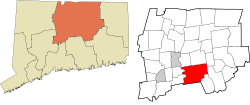
Glastonbury (/ˈɡlæstənbɛri/ GLAST-ən-berr-ee) is a town in the Capitol Planning Region, Connecticut, United States, formally founded in 1693 and first settled in 1636. It was named after Glastonbury in Somerset, England.[3] Glastonbury is on the banks of the Connecticut River, 7 miles (11 km) southeast of Hartford. The town center is defined by the U.S. Census Bureau as a census-designated place (CDP). The population was 35,159 at the 2020 census.[2]
- ^ "Town Leadership / Town Council | Glastonbury, CT".
- ^ a b "Census - Geography Profile: Glastonbury town, Hartford County, Connecticut". United States Census Bureau. Retrieved December 16, 2021.
- ^ The Connecticut Magazine: An Illustrated Monthly. Connecticut Magazine Company. 1903. p. 332.


