| Glatt | |
|---|---|
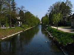
 At Dübendorf | |
 | |
| Location | |
| Country | Switzerland |
| Canton | Zürich |
| Physical characteristics | |
| Source | |
| • location | Greifensee |
| • elevation | 435 m (1,427 ft) |
| Mouth | |
• location | Rhine (Rheinsfelden) |
• coordinates | 47°34′26″N 8°28′15″E / 47.5740°N 8.4709°E |
• elevation | 356 m (1,168 ft) |
| Length | 35.7 km (22.2 mi) [1] |
| Basin features | |
| Progression | Rhine→ North Sea |
Glatt (German pronunciation: [ˈɡlat]) is the name of a lesser affluent to the High Rhine in the Unterland of the canton of Zurich, Switzerland. It is 35.7 kilometres (22.2 mi) long and flows out from the Greifensee through the Glatt Valley, discharging into the Rhine by Glattfelden. Whereas the upper reaches are only gently inclined, the stream gets steeper beneath, forming banks of bed load.