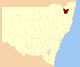
| Glen Innes Severn New South Wales | |||||||||||||||
|---|---|---|---|---|---|---|---|---|---|---|---|---|---|---|---|
 Location in New South Wales | |||||||||||||||
| Coordinates | 29°43′S 151°45′E / 29.717°S 151.750°E | ||||||||||||||
| Population |
| ||||||||||||||
| • Density | 1.61035/km2 (4.1708/sq mi) | ||||||||||||||
| Area | 5,487 km2 (2,118.5 sq mi) | ||||||||||||||
| Mayor | Margot Davis | ||||||||||||||
| Council seat | Glen Innes[3] | ||||||||||||||
| Region | New England | ||||||||||||||
| State electorate(s) | Northern Tablelands | ||||||||||||||
 | |||||||||||||||
| Website | Glen Innes Severn | ||||||||||||||
| |||||||||||||||
Glen Innes Severn is a local government area in the New England region of New South Wales, Australia. The council serves an area of 5,487 square kilometres (2,119 sq mi) and is located adjacent to the New England Highway. The council was formed by the amalgamation of Severn Shire and Glen Innes City Council.
- ^ Australian Bureau of Statistics (27 June 2017). "Glen Innes Severn (A)". 2016 Census QuickStats. Retrieved 8 December 2017.
- ^ "3218.0 – Regional Population Growth, Australia, 2017–18". Australian Bureau of Statistics. 27 March 2019. Retrieved 27 March 2019. Estimated resident population (ERP) at 30 June 2018.
- ^ "Glen Innes Severn Council". Division of Local Government. Retrieved 2 December 2006.