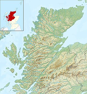
| Glen Strathfarrar National Scenic Area | |
|---|---|
 View along the glen across Loch Beannacharan, with Sgùrr na Lapaich beyond | |
| Location | Highland, Scotland |
| Coordinates | 57°24′51″N 4°50′21″W / 57.41417°N 4.83917°W |
| Area | 40 km2 (15 sq mi)[1] |
| Established | 1981 |
| Governing body | NatureScot |
Glen Strathfarrar (Scottish Gaelic: Srath Farair) is a glen in the Highland region of Scotland, near Loch Ness.
The Glen is part of the Affric-Beauly hydro-electric power scheme, with a dam at Loch Monar and a 9 km tunnel carrying water to an underground power station at Deanie; a second dam just below Loch Beannacharan feeds a tunnel carrying water to Culligran power station (also underground).[2] The Monar dam at Loch Monar is the largest arch dam in Britain.[3]
The central section of Glen Strathfarrar (covering 4,027 ha (9,950 acres)[1]) is designated as a national scenic area,[4] one of forty such areas in Scotland, which have been defined so as to identify areas of exceptional scenery and to ensure its protection from inappropriate development.[5] The area covered by the NSA represents the section of the glen least affected by the hydro-electric scheme, and includes the Culligran Falls.[6]
- ^ a b "National Scenic Areas - Maps". SNH. 20 December 2010. Archived from the original on 12 June 2018. Retrieved 24 January 2018.
- ^ "Power From the Glens" (PDF). Scottish and Southern Energy. p. 12. Archived from the original (PDF) on 18 October 2007. Retrieved 8 March 2008.
- ^ Cite error: The named reference
smgwas invoked but never defined (see the help page). - ^ "Glen Strathfarrar National Scenic Area". NatureScot. Retrieved 2 October 2020.
- ^ "National Scenic Areas". NatureScot. Retrieved 2 October 2020.
- ^ "The special qualities of the National Scenic Areas" (PDF). Scottish Natural Heritage. 2010. Retrieved 6 March 2018.
