| Gloucester New South Wales | |
|---|---|
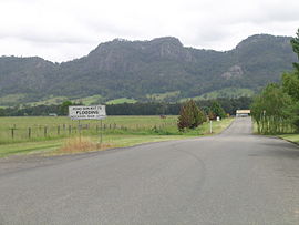
 The Bucketts Range, Gloucester, 2008 | |
| Coordinates | 32°00′34″S 151°57′37″E / 32.00944°S 151.96028°E |
| Population | 2,390 (2016 census)[1] |
| Established | 1855 |
| Postcode(s) | 2422 |
| Elevation | 111 m (364 ft)[2] |
| Location | |
| LGA(s) | Mid-Coast Council |
| State electorate(s) | Upper Hunter |
| Federal division(s) | Lyne |
Gloucester (/ˈɡlɒstər/ GLOST-ər), a town in dairy and beef cattle country, is located in Mid-Coast Council, within the Barrington Coast hinterland of the lower Mid North Coast of the state of New South Wales, Australia. It is the closest town to world heritage Barrington Tops National Park.[3]
Gloucester is situated on the North Coast railway line and can be accessed from the southeast from Newcastle, located 145 kilometres (90 mi) via the Bucketts Way, or from the north via Thunderbolts Way. Gloucester River flows adjacent to the town, just above its junction with the Avon River.
At the 2016 census, Gloucester had a population of 2,390 people.[1]
- ^ a b Australian Bureau of Statistics (27 June 2017). "Gloucester (Urban Centre and Locality)". 2016 Census QuickStats. Retrieved 4 February 2019.
 Material was copied from this source, which is available under a Creative Commons Attribution 4.0 International License.
- ^ a b "Map of Gloucester, NSW". Bonzle Digital Atlas of Australia. Retrieved 16 March 2013.
- ^ Barrington Coast
