Gloverville, South Carolina | |
|---|---|
 Gloverville Post Office | |
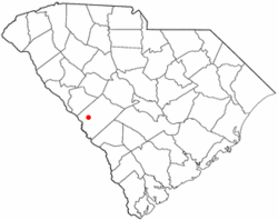
 Location of Gloverville, South Carolina | |
| Coordinates: 33°31′36″N 81°49′24″W / 33.52667°N 81.82333°W | |
| Country | |
| State | |
| County | |
| Area | |
| • Total | 3.64 sq mi (9.42 km2) |
| • Land | 3.63 sq mi (9.40 km2) |
| • Water | 0.01 sq mi (0.02 km2) |
| Elevation | 203 ft (62 m) |
| Population | |
| • Total | 2,406 |
| • Density | 663.18/sq mi (256.02/km2) |
| Time zone | UTC-5 (Eastern (EST)) |
| • Summer (DST) | UTC-4 (EDT) |
| ZIP code | 29828 |
| Area code(s) | 803, 839 |
| FIPS code | 45-29410[3] |
| GNIS feature ID | 1231324[4] |
Gloverville is a census-designated place (CDP) in Aiken County, South Carolina, United States. The population was 2,831 at the 2010 census.[5] It is part of the Augusta, Georgia metropolitan area. Gloverville is located in historic Horse Creek Valley.
- ^ "ArcGIS REST Services Directory". United States Census Bureau. Retrieved October 15, 2022.
- ^ "Census Population API". United States Census Bureau. Retrieved October 15, 2022.
- ^ "U.S. Census website". United States Census Bureau. Retrieved January 31, 2008.
- ^ "US Board on Geographic Names". United States Geological Survey. October 25, 2007. Retrieved January 31, 2008.
- ^ "Geographic Identifiers: 2010 Demographic Profile Data (G001): Gloverville CDP, South Carolina". U.S. Census Bureau, American Factfinder. Archived from the original on February 12, 2020. Retrieved August 6, 2013.