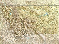
Going-to-the-Sun Road | |
 The road is often cut into steep rock | |
Location in Montana | |
| Location | Glacier National Park, Flathead and Glacier counties, Montana, U.S. |
|---|---|
| Nearest city | West Glacier, Montana |
| Coordinates | 48°41′42″N 113°49′01″W / 48.695°N 113.817°W |
| Built | 1921–1932; dedicated 1933 |
| Architect | National Park Service; Bureau of Public Roads |
| NRHP reference No. | 83001070 |
| Significant dates | |
| Added to NRHP | June 16, 1983[1] |
| Designated NHL | February 18, 1997[2] |
Going-to-the-Sun Road is a scenic mountain road in the Rocky Mountains of the western United States, in Glacier National Park in Montana. The Sun Road, as it is sometimes abbreviated in National Park Service documents, is the only road that traverses the park, crossing the Continental Divide through Logan Pass at an elevation of 6,646 feet (2,026 m), which is the highest point on the road.[3] Construction began in 1921 and was completed in 1932 with formal dedication in the following summer on July 15, 1933.[4][5] Prior to the construction of the road, visitors would need to spend several days traveling through the central part of the park, an area which can now be traversed within a few hours, excluding any stops for sightseeing or construction.
The road is the first to have been registered in all of the following categories: National Historic Place,[6] National Historic Landmark[2] and Historic Civil Engineering Landmark.[7] The road is approximately 50 miles (80 km) long and spans the width of the park between the east and west entrance stations.[3] The National Historic Landmark Nomination records a slightly shorter distance of 48.7 miles which is measured from the first main intersection just outside the park's west entrance to Divide Creek in St. Mary, Montana on the east side of the park.[3]
- ^ "National Register Information System". National Register of Historic Places. National Park Service. January 23, 2007.
- ^ a b "Going-to-the-Sun Road". National Historic Landmark summary listing. National Park Service. Archived from the original on January 9, 2016. Retrieved January 9, 2016.
- ^ a b c Cite error: The named reference
npsgttswas invoked but never defined (see the help page). - ^ Scott, Tristan (April 7, 2011). "Glacier's Going-to-the-Sun Road to open July 13, 2nd latest ever". Missoulian. Archived from the original on April 26, 2012. Retrieved January 9, 2016.
- ^ "Session due on Sun Road improvement". Spokesman-Review. July 18, 1967. p. 6.
- ^ "National Register of Historic Places Inventory - Nomination Form". National Park Service. June 16, 1983. Archived from the original on January 9, 2016. Retrieved January 9, 2016.
- ^ "Top 10 Things...#2". National Park Service. January 9, 2016. Retrieved January 9, 2016.

