| Gonarezhou National Park | |
|---|---|
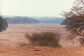
 Buffalo Bend on the Mwenezi River, Gonarezhou National Park, Zimbabwe | |
 | |
| Location | Chiredzi (District), Zimbabwe. |
| Coordinates | 21°40′S 31°40′E / 21.667°S 31.667°E |
| Area | 5,053 km2 (1,951 sq mi)[1] |
| Established | 1975 |
Gonarezhou National Park is a national park located in southeastern Zimbabwe.[2][3] It is situated in a relatively remote corner of Masvingo Province, south of Chimanimani along the Mozambique border. Owing to its vast size, rugged terrain and its location away from main tourist routes, large tracts of Gonarezhou remain pristine wilderness.
At 5,053 km2, Gonarezhou is the country's second-largest national park, after Hwange National Park.[1] The name Gonarezhou is translated from the Shona meaning "The Place of Elephants".
Gonarezhou National Park forms part of the Great Limpopo Transfrontier Park, a peace park that links Gonarezhou with the Kruger National Park in South Africa and the Limpopo National Park in Mozambique. Animals can move freely between the three sanctuaries. The northeastern end of Gonarezhou is located within the Zambezian and mopane woodlands, while the southwestern end is located within the Southern Africa bushveld ecoregion.
- ^ a b National Parks and Nature Reserves of Zimbabwe, World Institute for Conservation and Environment Archived 2012-04-16 at the Wayback Machine
- ^ "Gonarezhou". Gonarezhou National Park. Retrieved 2022-08-15.
- ^ Matiza, T.; Crafter, S. A., eds. (1994). "Wetlands in Zimbabwe: an overview". Wetlands ecology and priorities for conservation in Zimbabwe: proceedings of a seminar on wetlands ecology and priorities for conservation in Zimbabwe. IUCN. pp. 1–20. ISBN 978-2-8317-0202-5.