Goodhue County | |
|---|---|
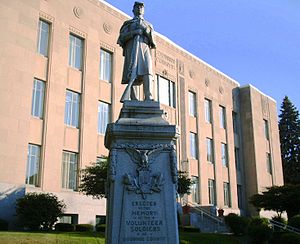
 Goodhue County Courthouse in Red Wing, Minnesota | |
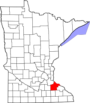
 Location within the U.S. state of Minnesota | |
 Minnesota's location within the U.S. | |
| Coordinates: 44°25′N 92°43′W / 44.41°N 92.72°W | |
| Country | |
| State | |
| Founded | March 5, 1853 |
| Named for | James M. Goodhue |
| Seat | Red Wing |
| Largest city | Red Wing |
| Area | |
| • Total | 780 sq mi (2,000 km2) |
| • Land | 757 sq mi (1,960 km2) |
| • Water | 24 sq mi (60 km2) 3.0% |
| Population (2020) | |
| • Total | 47,582 |
| • Estimate (2023) | 48,035 |
| • Density | 62.9/sq mi (24.3/km2) |
| Time zone | UTC−6 (Central) |
| • Summer (DST) | UTC−5 (CDT) |
| Congressional district | 1st |
| Website | www |
Goodhue County (/ˈɡʊdhjuː/ GUUD-hew)[1] is a county in the U.S. state of Minnesota. As of the 2020 census, the population was 47,582.[2] Its county seat is Red Wing.[3] Nearly all of Prairie Island Indian Community is within the county.
Goodhue County comprises the Red Wing, MN Micropolitan Statistical Area and is included in the Minneapolis-St. Paul, MN-WI Combined Statistical Area.
- ^ "Minnesota Pronunciation Guide". Associated Press. Archived from the original on July 22, 2011. Retrieved July 4, 2011.
- ^ "State & County QuickFacts". United States Census Bureau. Retrieved April 15, 2023.
- ^ "Find a County". National Association of Counties. Archived from the original on May 31, 2011. Retrieved June 7, 2011.


