This article's tone or style may not reflect the encyclopedic tone used on Wikipedia. (July 2017) |
Govenlock | |
|---|---|
| Coordinates: 49°15′43″N 109°48′32″W / 49.261845°N 109.80878°W | |
| Country | Canada |
| Province | Saskatchewan |
| Region | Southwest Saskatchewan |
| Census division | 4 |
| Rural Municipality | Reno No. 51 |
| Established | 1910 |
| Incorporated (Village) | 1913-1976 |
| Dissolved | January 1, 1976 |
| Government | |
| • Reeve | Brian McMillan |
| • Administrator | Lacelle Kim |
| • Governing body | Reno No. 51 |
| • MP | Jeremy Patzer |
| • MLA | Doug Steele |
| Area | |
| • Total | 0.00 km2 (0.00 sq mi) |
| Population (2019) | |
| • Total | 0 |
| • Density | 0.0/km2 (0/sq mi) |
| Postal code | S0N 2G0 |
| Area code | 306 |
| Highways | Highway 13 Highway 21 |
| Railways | Former Canadian Pacific Railway |
| [1][2][3][4] | |
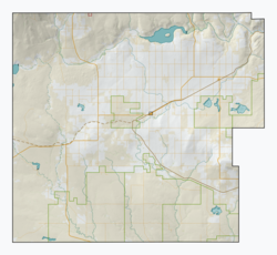
Govenlock is an unincorporated community within the Rural Municipality of Reno No. 51, Saskatchewan, Canada. It previously held the status of a village, with a peak population of 151 residents; its village status was dissolved on January 1, 1976. The former townsite of Govenlock is located on Highway 21 and Highway 13, also known as the historic Red Coat Trail, about 15 kilometres (9.3 mi) east of the Alberta-Saskatchewan border. Although many cement foundations and wooden sidewalks can still be found scattered around the town site, the only building that still stands as of 2010 is the old community hall and a commemorative plaque in remembrance of Govenlock's history.
- ^ National Archives, Archivia Net, Post Offices and Postmasters, archived from the original on October 6, 2006
- ^ Government of Saskatchewan, MRD Home, Municipal Directory System, archived from the original on November 21, 2008
- ^ Canadian Textiles Institute. (2005), CTI Determine your provincial constituency, archived from the original on September 11, 2007
- ^ Commissioner of Canada Elections, Chief Electoral Officer of Canada (2005), Elections Canada On-line, archived from the original on April 21, 2007

