This article has multiple issues. Please help improve it or discuss these issues on the talk page. (Learn how and when to remove these messages)
|
Governorate of Livonia
| |
|---|---|
 Location in the Russian Empire | |
| Country | Russian Empire |
| Established | 1796 |
| Treaty of Brest-Litovsk | 1918 |
| Capital | Riga |
| Area | |
| • Total | 47,030.87 km2 (18,158.72 sq mi) |
| Highest elevation | 318 m (1,043 ft) |
| Population (1897) | |
| • Total | 1,299,365 |
| • Density | 28/km2 (72/sq mi) |
| • Urban | 29.31% |
| • Rural | 70.69% |

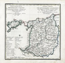
The Governorate of Livonia, also known as the Livonia Governorate,[a] was a province (guberniya) and one of the Baltic governorates of the Russian Empire, Baltic Governorate-General until 1876. Governorate of Livonia bordered Governorate of Estonia to the north, Saint Petersburg and Pskov Governorates to the east, Courland Governorate to the south, and the Gulf of Riga to the west. In 1897, the population of the governorate was 1,299,365, and it had an area of 47,030.87 square kilometres (18,158.72 sq mi). The administrative centre of the governorate was the Baltic Sea port of Riga. It roughly corresponded to most of the modern Vidzeme Region of Latvia and southern Estonia.[1]
Cite error: There are <ref group=lower-alpha> tags or {{efn}} templates on this page, but the references will not show without a {{reflist|group=lower-alpha}} template or {{notelist}} template (see the help page).
- ^ The Baltic States from 1914 to 1923 By LtCol Andrew Parrott Archived 19 March 2009 at the Wayback Machine

