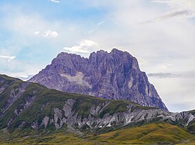
| Parco Nazionale del Gran Sasso e Monti della Laga | |
|---|---|
 | |
| Nearest city | L'Aquila, Teramo |
| Coordinates | 42°29′N 13°28′E / 42.483°N 13.467°E |
| Area | 1,413.31 km2 (545.68 sq mi) |
| Established | 1991 |
| Governing body | Ministero dell'Ambiente |
| www | |
The Gran Sasso and Monti della Laga National Park is a natural park in central Italy. Established in 1991, it covers an area of 2,014 square kilometres (778 sq mi), mostly within the provinces of Teramo, L'Aquila, and Pescara in Abruzzo, with small areas in the provinces of Rieti in Lazio and Ascoli Piceno in Marche. The terrain is predominantly mountainous with alpine plains.
It is managed by Ente Parco Nazionale Gran Sasso e Monti della Laga, with headquarters in Assergi, L'Aquila.
The Grand Highway of the Gran Sasso and Monti della Laga National Park runs through the park between the Gran Sasso mountain peak and the chain known as Monti della Laga.
