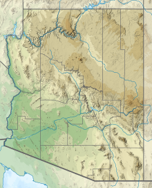
Grand Canyon National Park Airport | |||||||||||
|---|---|---|---|---|---|---|---|---|---|---|---|
 | |||||||||||
| Summary | |||||||||||
| Airport type | Public | ||||||||||
| Owner | State of Arizona | ||||||||||
| Serves | Grand Canyon | ||||||||||
| Location | Tusayan, Arizona | ||||||||||
| Elevation AMSL | 6,609 ft / 2,014 m | ||||||||||
| Coordinates | 35°57′08″N 112°08′49″W / 35.95222°N 112.14694°W | ||||||||||
| Website | http://www.azdot.gov/ | ||||||||||
| Maps | |||||||||||
 FAA airport diagram as of January 2021 | |||||||||||
 | |||||||||||
| Runways | |||||||||||
| |||||||||||
| Statistics (2021) | |||||||||||
| |||||||||||
Grand Canyon National Park Airport (IATA: GCN, ICAO: KGCN, FAA LID: GCN) is a state-owned public-use airport located in Tusayan, CDP in unincorporated Coconino County, Arizona, United States.[2][3] It is near Grand Canyon National Park, 1 mile (0.87 nmi; 1.6 km) from the South Rim entrance of the Grand Canyon. The airport is primarily used for scenic tours and charter flights.
As per Federal Aviation Administration records, the airport had 294,436 passenger boardings (enplanements) in calendar year 2008 and 354,624 enplanements in 2007.[4] According to the FAA's National Plan of Integrated Airport Systems for 2009–13, it is categorized as commercial service – primary.[5]
- ^ FAA Airport Form 5010 for GCN PDF. Federal Aviation Administration. Effective August 10, 2023.
- ^ "Our Location Archived 2011-07-11 at the Wayback Machine." Grand Canyon Airlines. Retrieved on October 3, 2009.
- ^ "Tusayan CDP, Arizona[permanent dead link]." U.S. Census Bureau. Retrieved on October 3, 2009.
- ^ Passenger Boarding (Enplanement) Data for CY 2008. Federal Aviation Administration. Updated 18 December 2009.
- ^ National Plan of Integrated Airport Systems for 2009–2013: Appendix A: Part 1 (PDF, 1.33 MB) Archived 2011-08-06 at the Wayback Machine. Federal Aviation Administration. Updated 15 October 2008.

