| Grand Hogback | |
|---|---|
 Part of the Grand Hogback near New Castle, Colorado. | |
| Highest point | |
| Elevation | 2,212 m (7,257 ft)[1] |
| Coordinates | 39°37′07″N 107°45′17″W / 39.61861°N 107.75472°W |
| Geography | |
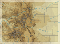
The Grand Hogback is a 70-mile long,[2] curving, spine-like ridge in Western Colorado that extends from near McClure Pass in Pitkin County through Garfield County and then to near Meeker in Rio Blanco County.[3] The hogback is significant because it marks part of the boundary between the Colorado Plateau to the west and the Southern Rocky Mountains to the east.[4]
The elevation of the ridge ranges from 7,710 ft (2,350 m) to 9,194 ft (2,802 m). The hogback appears as a series of serrated ridges and is easily discernable from Google Maps and other aerial views.[4] It is visible from Interstate 70.
- ^ "Grand Hogback". Geographic Names Information System. United States Geological Survey, United States Department of the Interior. Retrieved March 27, 2017.
- ^ New Castle, Colorado. Living in New Castle[permanent dead link]. Retrieved: March 27, 2017.
- ^ Stracher, Glenn B.; et al. (2008). "Revisiting the South Cañon Number 1 Coal Mine fire during a geologic excursion from Denver to Glenwood Springs, Colorado". In Raynolds, Robert G. H. (ed.). Roaming the Rocky Mountains and Environs: Geological Field Trips. Geological Society of America. pp. 101–110. ISBN 9780813700106.
- ^ a b Colorado Mountain College. The Grand Hogback: Living life on the edge. Retrieved: March 27, 2017.
