| Grand Portage State Park | |
|---|---|
 High Falls of the Pigeon River in Grand Portage State Park | |
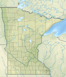
| Location | Cook, Minnesota, United States |
| Coordinates | 48°0′37″N 89°36′43″W / 48.01028°N 89.61194°W |
| Area | 278 acres (113 ha) |
| Elevation | 846 ft (258 m)[1] |
| Established | 1989 |
| Governing body | Minnesota Department of Natural Resources, Grand Portage Indian Reservation |
Grand Portage State Park is a state park at the northeastern tip of the U.S. state of Minnesota, on the Canada–United States border. It contains a 120-foot (37 m) waterfall, the tallest in the state (though it is on the border with Canada and thus partially in Ontario), on the Pigeon River. The High Falls and other waterfalls and rapids upstream necessitated a historically important portage on a fur trade route between the Great Lakes and inland Canada. This 8.5-mile (13.7 km) path as well as the sites of historic forts at either end are preserved in nearby Grand Portage National Monument.
The state park, held by the surrounding Grand Portage Indian Reservation and leased to the state of Minnesota for $1 a year, is the only U.S. state park jointly managed by a state and a Native American band.[2] It is also the only Minnesota state park not owned by the state.[3]
- ^ "Grand Portage State Park". Geographic Names Information System. United States Geological Survey. August 17, 2000. Retrieved February 24, 2011.
- ^ Lien, Dennis (December 14, 2000). "Indians regain land". St. Paul Pioneer Press. St. Paul, Minn.
- ^ Oakes, Larry (September 26, 1994). "An historic partnership - Joint management lends Indian perspective to soon-to-open state park". Star Tribune. Minneapolis, Minn.

