This article relies largely or entirely on a single source. (November 2020) |
Grand Prairie Area Demonstration Project | |
|---|---|
 Pump station at DeValls Bluff | |
| Begins | White River, DeValls Bluff, Arkansas 37°49′48″N 121°33′25″W / 37.829927°N 121.556894°W |
| Official name | Grand Prairie Area Demonstration Project |
| Characteristics | |
| Capacity | 1,640 cu ft (46 m3) per second |
| History | |
| Construction start | 1950 |

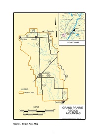
The Grand Prairie Area Demonstration Project is an interbasin transfer project to provide water to eastern Arkansas for the purposes of agricultural water supply, aquifer recharge, prairie and wetland restoration, water conservation and waterfowl management. The project, conceived by the US Army Corps of Engineers' Memphis District and approved by US Congress in 1950, generally involves the pumping of water from the White River near DeValls Bluff into pipelines and canals throughout Arkansas's Grand Prairie, specifically to farmers in Arkansas, Lonoke and Prairie counties. The new water source is intended to relieve groundwater pumping from the Alluvial and Sparta aquifers that underlie the Prairie.