This article needs additional citations for verification. (June 2007) |
| Grand River Tributary to Missouri River | |
|---|---|
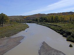
 The Grand River near Little Eagle | |
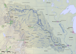
 The Grand River shown as a tributary of the Missouri River | |
| Location | |
| Country | United States |
| State | South Dakota |
| Counties | Corson Perkins |
| Physical characteristics | |
| Source | confluence of North Fork and South Fork Grand River |
| • location | Shadehill Reservoir |
| • coordinates | 45°45′9.93″N 102°11′55.56″W / 45.7527583°N 102.1987667°W[1] |
| • elevation | 2,220 ft (680 m)[1] |
| Mouth | Missouri River |
• location | about 1-mile northwest of Mobridge, South Dakota |
• coordinates | 45°34′36.98″N 102°28′17.49″W / 45.5769389°N 102.4715250°W[1] |
• elevation | 1,608 ft (490 m)[1] |
| Length | 177.46 mi (285.59 km)[2] |
| Basin size | 5,590.47 square miles (14,479.3 km2)[3] |
| Discharge | |
| • location | Missouri River |
| • average | 306.53 cu ft/s (8.680 m3/s) at mouth with Missouri River[3] |
| Basin features | |
| Progression | Missouri River → Mississippi River → Gulf of Mexico |
| River system | Missouri River |
| Tributaries | |
| • left | North Fork Grand River, Flat Creek, Dog Tooth Creek, Thunder Hawk Creek, Cyclone Creek, Deer Creek, Willow Creek, Cedar Boy Creek, Dirt Lodge Creek, Soldier Creek, Hump Creek, White Shirt Creek, Stink Creek, Rock Creek |
| • right | South Fork Grand River, Cottonwood Creek, Black Horse Butte Creek, Meadow Creek, Cottonwood Creek, Louise Creek, Firesteel Creek, Plum Creek, High Bank Creek, Little Oak Creek, Deep Bank Creek, Snake Creek, Claymore Creek |
| Bridges | Hugh Glass Road, SD 73, 116th Street, 209th Avenue, 215th Avenue, 119th Street, County Road, County Road, SD 65, unnamed road (x2), Brown Otter xing, CS 15, SD 63, US 12, SD 1806 (Singing Bridge) |
The Grand River (Lakota: Čhaŋšúška Wakpá[4]) is a tributary of the Missouri River in South Dakota in the United States. The length of the combined branch is 110 mi (177 km). With its longest fork, its length is approximately 200 mi (320 km).
- ^ a b c d "Geographic Names Information System". edits.nationalmap.gov. US Geological Survey. Retrieved January 15, 2023.
- ^ "ArcGIS Web Application". epa.maps.arcgis.com. US EPA. Retrieved January 15, 2023.
- ^ a b "Watershed Report | Office of Water | US EPA". watersgeo.epa.gov. US EPA. Retrieved January 15, 2023.
- ^ Ullrich, Jan, ed. (2011). New Lakota Dictionary (2nd ed.). Bloomington, IN: Lakota Language Consortium. p. 955. ISBN 978-0-9761082-9-0. LCCN 2008922508.

