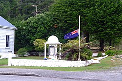
Granity | |
|---|---|
 Granity War Memorial | |
 | |
| Coordinates: 41°37′47″S 171°51′13″E / 41.62972°S 171.85361°E | |
| Country | New Zealand |
| Region | West Coast |
| District | Buller District |
| Ward | Seddon |
| Electorates | |
| Government | |
| • Territorial authority | Buller District Council |
| • Regional council | West Coast Regional Council |
| • Mayor of Buller | Jamie Cleine |
| • West Coast-Tasman MP | Maureen Pugh |
| • Te Tai Tonga MP | Tākuta Ferris |
| Area | |
| • Total | 2.36 km2 (0.91 sq mi) |
| Population (June 2023)[2] | |
| • Total | 170 |
| • Density | 72/km2 (190/sq mi) |
Granity is a small town on the West Coast of New Zealand's South Island, 28 kilometres (17 mi) north-east of Westport on State Highway 67. Karamea is 68 kilometres (42 mi) further north.[3][4]
The town is on a narrow strip of land between the Tasman Sea to the west and steep, mountains to the immediate east. Long known as a coal-mining town, the population declined as the industry waned. The population was 170 in June 2023.[2] Several neighbouring towns, such as Denniston, have become virtually ghost towns. In 1911 Granity's population was 589,[5] 641 in 1921[6] and 547 in 1956.[7] Granity had a railway station on the Westport-Ngākawau Line from 28 Feb 1892 until 16 May 1982, though closed to passengers from 14 October 1946.[8] In 1902 it had a staff of 5.[9]
The name "Granity" was given to the town by gold prospectors, in reference to the large quantity of granite in the area.[10]
- ^ Cite error: The named reference
Areawas invoked but never defined (see the help page). - ^ a b "Subnational population estimates (RC, SA2), by age and sex, at 30 June 1996-2023 (2023 boundaries)". Statistics New Zealand. Retrieved 25 October 2023. (regional councils); "Subnational population estimates (TA, SA2), by age and sex, at 30 June 1996-2023 (2023 boundaries)". Statistics New Zealand. Retrieved 25 October 2023. (territorial authorities); "Subnational population estimates (urban rural), by age and sex, at 30 June 1996-2023 (2023 boundaries)". Statistics New Zealand. Retrieved 25 October 2023. (urban areas)
- ^ Peter Dowling, ed. (2004). Reed New Zealand Atlas. Reed Books. map 62. ISBN 0-7900-0952-8.
- ^ Roger Smith, GeographX (2005). The Geographic Atlas of New Zealand. Robbie Burton. map 134. ISBN 1-877333-20-4.
- ^ "Report on the results of a census of the Dominion of New Zealand" (PDF). 2 April 1911.
- ^ "1921 Census - Part 01 - Population". statsnz.contentdm.oclc.org. Retrieved 3 September 2022.
- ^ "1956 Census - Part 01 - Increase and Location of Population". statsnz.contentdm.oclc.org. Retrieved 3 September 2022.
- ^ Scoble, Juliet (April 2010). "Names & Opening & Closing Dates of Railway Stations in New Zealand 1863 to 2010" (PDF). Rail Heritage Trust of New Zealand.
- ^ "Granity". nzetc.victoria.ac.nz. Retrieved 3 September 2022.
- ^ Reed, A. W. (2002). The Reed Dictionary of New Zealand Place Names. Auckland: Reed Books. ISBN 0-7900-0761-4.