| Granville Sydney, New South Wales | |||||||||||||||
|---|---|---|---|---|---|---|---|---|---|---|---|---|---|---|---|
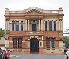
 Granville Town Hall (2024) | |||||||||||||||
 | |||||||||||||||
| Population | 16,716 (SAL 2021)[1] | ||||||||||||||
| Established | 1855 | ||||||||||||||
| Postcode(s) | 2142 | ||||||||||||||
| Elevation | 17 m (56 ft) | ||||||||||||||
| Area | 3.3 km2 (1.3 sq mi) | ||||||||||||||
| Location | 18 km (11 mi) W of Sydney CBD | ||||||||||||||
| LGA(s) | |||||||||||||||
| State electorate(s) | Granville | ||||||||||||||
| Federal division(s) | Parramatta | ||||||||||||||
| |||||||||||||||
Granville is a suburb in Western Sydney, in the state of New South Wales, Australia. Granville is located 18 kilometres (11 mi) west of the Sydney central business district, split between the local government areas of Cumberland City Council and the City of Parramatta.
South Granville is a separate suburb. Lisgar, Redfern, Heath and Mona Streets form the approximate border between Granville and South Granville. The Duck River provides a boundary with Auburn, to the east.
- ^ Australian Bureau of Statistics (28 June 2022). "Granville (NSW) (suburb and locality)". Australian Census 2021 QuickStats. Retrieved 28 June 2022.