| Grass River Grasse River | |
|---|---|
 | |
 | |
| Location | |
| Country | |
| State | |
| Physical characteristics | |
| Source | Middle Branch Grass River, South Branch Grass River |
| Mouth | St. Lawrence River |
• location | Massena, New York |
• coordinates | 44°59′12″N 74°46′14″W / 44.9868°N 74.7706°W |
• elevation | 171 ft (52 m) |
| Length | 73 mi (117 km) |
| Basin size | 619 sq mi (1,600 km2) |
| Basin features | |
| Tributaries | |
| • left | Black Brook, Plumb Brook, Gibbons Brook, Harrison Creek, Line Creek, Massena Power Canal |
| • right | North Branch Grass River, Pleasant Creek, Edmond Brook, Little River, Nettle Creek, McConnell Creek |
| Waterfalls | Lampsons Falls |
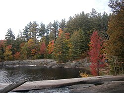
The Grasse River or Grass River (per 1905 decision of the U.S. Board on Geographic Names) is a 73-mile-long (117 km)[1] river in northern New York, in the United States. The river mainly flows northeast from the foothills of the Adirondack Mountains into the St. Lawrence Valley, making up what is known as the greater St. Lawrence River Drainage Basin along with other tributaries such as the Oswegatchie and Raquette rivers.
The river was named after François Joseph Paul, comte de Grasse,[citation needed] a French admiral and hero of the American Revolutionary War. He defeated British forces in the Battle of the Chesapeake, contributing to their surrender at Yorktown, ending the war.


- ^ "The National Map". U.S. Geological Survey. Archived from the original on 2012-03-29. Retrieved Feb 11, 2011.