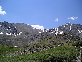
| Grays Peak | |
|---|---|
 Grays Peak on left, Torreys Peak on right | |
| Highest point | |
| Elevation | 14,278 ft (4352 m)[1] NAVD88 |
| Prominence | 2770 ft (844 m)[2] |
| Isolation | 25.0 mi (40.2 km)[2] |
| Listing | |
| Coordinates | 39°38′02″N 105°49′03″W / 39.6338834°N 105.8175704°W[1] |
| Naming | |
| Etymology | Asa Gray |
| Geography | |
| Location | High point of the Continental Divide in North America and the high point of both Clear Creek and Summit counties, Colorado, U.S.[2] |
| Parent range | Highest summit of the Front Range[2] |
| Topo map | USGS 7.5' topographic map Grays Peak, Colorado[3] |
| Climbing | |
| First ascent | 1861 by Charles C. Parry |
| Easiest route | 3.5 mile (5.6 km) hike on Grays Peak Trail |
Grays Peak is the tenth-highest summit of the Rocky Mountains of North America and the U.S. state of Colorado. The prominent 14,278-foot (4352 m) fourteener is the highest summit of the Front Range and the highest point on the Continental Divide and the Continental Divide Trail in North America. (There are higher summits, such as Mount Elbert, which are near, but not on, the Divide.) Grays Peak is located in Arapahoe National Forest, 3.9 miles (6.2 km) southeast by east (bearing 122°) of Loveland Pass on the Continental Divide between Clear Creek and Summit counties. The peak is the highest point in both counties.[1][a][2][3]
Grays Peak is one of 53 fourteeners (mountains of over 14,000 feet (4,300 m) in elevation) in Colorado. Botanist Charles C. Parry made the first recorded ascent of the summit in 1861 and named the peak in honor of his botanist colleague Asa Gray. Gray did not see (and climb) the peak until 1872, eleven years later. Grays Peak is commonly mentioned in conjunction with adjacent Torreys Peak.[4] In the Arapaho language Gray's Peak and the adjacent Torrey's Peak are named, Heeniiyoowuu or "Ant Hills".[5]
- ^ a b c "GRAYS PEAK". NGS Data Sheet. National Geodetic Survey, National Oceanic and Atmospheric Administration, United States Department of Commerce. Retrieved January 2, 2016.
- ^ a b c d e "Grays Peak, Colorado". Peakbagger.com. Retrieved May 25, 2018.
- ^ a b "Grays Peak". Geographic Names Information System. United States Geological Survey, United States Department of the Interior. Retrieved November 14, 2014.
- ^ Gannett, Henry (1905). The Origin of Certain Place Names in the United States. Vol. 258 (2 ed.). Washington, DC: United States Geological Survey. pp. 142, 302.
- ^ "Colorado Places: Their Native American Names". Center for Native American and Indigenous Studies (CNAIS). 2020-07-24. Retrieved 2024-01-12.
Cite error: There are <ref group=lower-alpha> tags or {{efn}} templates on this page, but the references will not show without a {{reflist|group=lower-alpha}} template or {{notelist}} template (see the help page).
