| Great Central Lake | |
|---|---|
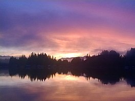
 Sunset at Great Central Lake | |
| Location | Vancouver Island, British Columbia |
| Coordinates | 49°22′05″N 125°11′45″W / 49.36806°N 125.19583°W |
| Type | Natural lake, Reservoir |
| Primary outflows | Stamp River, Somass River |
| Basin countries | Canada |
| Max. length | 45 km (28 mi) |
| Max. width | 2.45 km (1.52 mi) |
| Surface area | 50.85 km2 (19.63 sq mi) |
| Average depth | 124 m (407 ft) |
| Max. depth | 250 m (820 ft) |
| Water volume | 6.31 km3 (1.51 cu mi) |
| Shore length1 | 82.3 km (51.1 mi) |
| Surface elevation | 85 m (279 ft) |
| Islands | One island and numerous islets |
| References | [1][2] |
| 1 Shore length is not a well-defined measure. | |
Great Central Lake is a lake on Vancouver Island, British Columbia, Canada. It is located north of Sproat Lake and to the northwest of the city of Port Alberni. It is 45 kilometres (28 mi) long, with an area of 50.85 square kilometres (19.63 sq mi) and mean depth of 124 metres (407 ft), to a maximum of 250 metres (820 ft), making it the second deepest lake on Vancouver Island. The lake is long and narrow, with the exception of Trestle Bay located on the east end of the lake. It is nestled beneath low mountains, with second-growth forest surrounding most of the lake. The water level is controlled by a dam on the east side.
There are approximately 70 residents that live in float houses along the shoreline. Fishing, boating, skiing, wakeboarding, swimming, hiking, camping, and ATVing are common activities on and around the lake.
