| Great Falls of the Missouri River | |
|---|---|
 Black Eagle Falls and Dam in 2014 | |
 | |
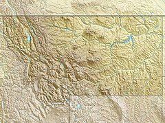
| Location | Cascade County, Montana, U.S. |
| Coordinates | 47°34′12″N 111°07′23″W / 47.57000°N 111.12306°W |
| Total height | 187 feet (57 m) |
| Number of drops | 5 |
| Longest drop | 87 feet (27 m) |
| Watercourse | Missouri River |
| Average flow rate | 7,539 cu ft/s (213.5 m3/s)[1] |
The Great Falls of the Missouri River are a series of waterfalls on the upper Missouri River in north-central Montana in the United States. From upstream to downstream, the five falls along a 10-mile (16 km) segment of the river[2] are:
- Black Eagle Falls (26 feet 5 inches or 8.05 meters)[2]
- Colter Falls (6 feet 7 inches or 2.01 meters)[2]
- Rainbow Falls (44 feet 6 inches or 13.56 meters)[2]
- Crooked Falls, also known as Horseshoe Falls (19 feet or 5.79 m)[2]
- Big Falls, also known as the Great Falls, (87 feet or 26.52 m)[2]
The Missouri River drops a total of 612 feet (187 m) from the first of the falls to the last, which includes a combined 187 feet (57 m) of vertical plunges and 425 feet (130 m) of riverbed descent.[3] The Great Falls have been described as "spectacular",[4] one of the "scenic wonders of America",[5] and "a major geographic discovery".[6] When the Lewis and Clark Expedition became the first white men to see the falls in 1805, Meriwether Lewis said they were the grandest sight he had beheld thus far in the journey.[7]
The Great Falls of the Missouri River were depicted on the territorial seal of the Montana Territory, and later on the state seal of Montana in 1893.[8]
- ^ Mineral and Water Resources of Montana. Stermitz, Frank; Hanly, T. F.; and Lane, C. W. Special Publication No. 28. Helena, Mont.: Montana Bureau of Mines and Geology, May 1963.
- ^ a b c d e f Cutright, Paul Russell, and Johnsgard, Paul A. Lewis and Clark: Pioneering Naturalists. 2d ed. Lincoln, Neb.: University of Nebraska Press, 2003. ISBN 0-8032-6434-8
- ^ "Great Falls of the Missouri River." Encyclopedia Americana. New York: Americana Corp., 1954.
- ^ Malone, Michael P. Montana Century: 100 Years in Pictures and Words. Guilford, Conn.: Globe Pequot, 1999. ISBN 1-56044-827-X
- ^ Montana Department of Agriculture. The Resources and Opportunities of Montana. Helena, Mont.: Montana Department of Agriculture, 1912.
- ^ Johnsgard, Paul A. Lewis and Clark on the Great Plains: A Natural History. Lincoln, Neb.: University of Nebraska Press, 2003. ISBN 0-8032-7618-4
- ^ Pritchett, Michael. The Melancholy Fate of Capt. Lewis. Columbia, Mo.: Unbridled Books, 2007. ISBN 1-932961-41-0
- ^ Shearer, Barbara Smith. State Names, Seals, Flags, and Symbols: A Historical Guide. 3rd rev. ed. Santa Barbara, Calif.: Greenwood Publishing Group, 2002. ISBN 0-313-31534-5

