| Greeba Bridge | |
|---|---|
 | |
| Coordinates | 54°11′48.5″N 4°36′20.9″W / 54.196806°N 4.605806°W |
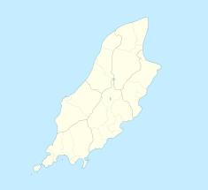
Greeba Bridge [1] is situated between the 6th milestone and 7th road milestones on the primary A1 Douglas to Peel road and the junction with the Greeba Mill Road in the parish of Kirk German in the Isle of Man.
The A1 Greeba road bridge passes over the Greeba river, a tributary of the River Dhoo which flows eastward to the town of Douglas. [2] The Greeba river flows into the nearby Greeba Curragh or ‘Greeba Gap,’ a former pre-Ice Age river valley,[3] a low-lying watershed of the Douglas to Peel central valley. [4][5]
- ^ Daily Express page 8 Saturday 16 June 1923
- ^ HM Ordnance Survey Landranger (1992) Sheet 95 ISLE OF MAN. Scale 1:50,000
- ^ A Gazetteer of the Isle of Man page 132 Leslie Qulliam RBV The Manx Heritage Foundation - Eiraght Ashoonagh Vannin (2005) Quine and Cubbon Ltd ISBN 0 951 4539 12
- ^ Evolution of the Natural Landscape Volume 1 The Holocene Page 311 edited by Richard Chiverrell, Dr. Geoff Thomas, John Belchem (2006) Liverpool University Press ISBN 0-85323-587-2
- ^ Isle of Man: Celebrating a Sense of Place page 93 Vaughan Robinson & Danny McCarroll Liverpool University Press (1990) ISBN 0853232962
