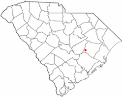
Greeleyville, South Carolina | |
|---|---|
 Downtown Greeleyville, SC | |
 Location of Greeleyville, South Carolina | |
| Coordinates: 33°34′53″N 79°59′22″W / 33.58139°N 79.98944°W | |
| Country | United States |
| State | South Carolina |
| County | Williamsburg |
| Incorporated | December 20, 1893 |
| Government | |
| • Mayor | Jessie Parker |
| Area | |
• Total | 1.22 sq mi (3.17 km2) |
| • Land | 1.22 sq mi (3.17 km2) |
| • Water | 0.00 sq mi (0.00 km2) |
| Elevation | 79 ft (24 m) |
| Population | |
• Total | 384 |
| • Density | 313.98/sq mi (121.18/km2) |
| Time zone | UTC-5 (Eastern (EST)) |
| • Summer (DST) | UTC-4 (EDT) |
| ZIP code | 29056 |
| Area code(s) | 843, 854 |
| FIPS code | 45-30535[3] |
| GNIS feature ID | 1245822[4] |
| Website | townofgreeleyville |
Greeleyville is a town in Williamsburg County, South Carolina, United States. The population was 438 at the 2010 census. The town was originally chartered on December 20, 1893. Greeleyville's seal and flag feature a depiction of the first Town Hall, which was built in the 1890s, as well as two arms, one black and one white, holding a tobacco leaf and a cotton boll.[5] These symbols represent the unity and cooperation among all the people of Greeleyville and pay tribute to the town's agricultural heritage.[5]
Since 1982, the town has hosted an annual Flag Day celebration each Memorial Day weekend that features bingo, street dances, barbecue, as well as various other types of vendors.[6][7]
- ^ "ArcGIS REST Services Directory". United States Census Bureau. Retrieved October 15, 2022.
- ^ Cite error: The named reference
USCensusDecennial2020CenPopScriptOnlywas invoked but never defined (see the help page). - ^ "U.S. Census website". United States Census Bureau. Retrieved January 31, 2008.
- ^ "US Board on Geographic Names". United States Geological Survey. October 25, 2007. Retrieved January 31, 2008.
- ^ a b "Greeleyville, South Carolina". www.sciway.net. Retrieved December 31, 2022.
- ^ Jonté, Bobby. "35 years of Flag Day". Manning Live. Retrieved December 31, 2022.
- ^ "More S.C. Festivals". The State (Columbia, South Carolina). October 19, 1997. Retrieved December 31, 2022.
