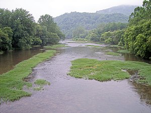
| Greenbrier River | |
|---|---|
 Greenbrier River at Marlinton, West Virginia | |
 | |
| Location | |
| Country | United States |
| State | West Virginia |
| Counties | Greenbrier, Monroe, Pocahontas, Summers |
| Physical characteristics | |
| Source | West Fork Greenbrier River |
| • location | Pocahontas County |
| • coordinates | 38°44′07″N 79°45′37″W / 38.73528°N 79.76028°W |
| • elevation | 3,396 ft (1,035 m) |
| 2nd source | East Fork Greenbrier River |
| • location | Pocahontas County |
| • coordinates | 38°41′04″N 79°39′31″W / 38.68444°N 79.65861°W |
| • elevation | 3,746 ft (1,142 m) |
| Source confluence | |
| • location | Durbin |
| • coordinates | 38°32′37″N 79°49′56″W / 38.54361°N 79.83222°W |
| • elevation | 2,710 ft (830 m) |
| Mouth | New River[1] |
• location | Hinton |
• coordinates | 37°39′13″N 80°53′05″W / 37.65361°N 80.88472°W |
• elevation | 1,365 ft (416 m) |
| Length | 162 mi (261 km)[2] |
| Basin size | 1,656 sq mi (4,290 km2)[2] |
| Discharge | |
| • location | Alderson[3] |
| • average | 2,600 cu ft/s (74 m3/s) |
| • minimum | 576 cu ft/s (16.3 m3/s)(1976) |
| • maximum | 10,200 cu ft/s (290 m3/s)(2000) |
| Basin features | |
| Tributaries | |
| • left | Sunday Lick Run, Knapp Creek, Anthony Creek |
| • right | Price Run, Hungard Creek |

The Greenbrier River is a tributary of the New River, 162 miles (261 km) long,[2] in southeastern West Virginia, in the United States. Via the New, Kanawha and Ohio rivers, it is part of the watershed of the Mississippi River, draining an area of 1,656 square miles (4,290 km2).[2] It is one of the longest rivers in West Virginia.[4]

- ^ U.S. Geological Survey Geographic Names Information System: Greenbrier River
- ^ a b c d McNeel, William P. "Greenbrier River." The West Virginia Encyclopedia. Ken Sullivan, editor. Charleston, WV: West Virginia Humanities Council. 2006. ISBN 0-9778498-0-5.
- ^ United States Geological Survey; USGS 03183500 GREENBRIER RIVER AT ALDERSON, WV; retrieved April 19, 2008.
- ^ greenbrierriver.org