| Gressenhall | |
|---|---|
 Gressenhall Workhouse Museum. | |
Location within Norfolk | |
| Area | 10.53 km2 (4.07 sq mi) |
| Population | 1,050 (2011)[1] |
| • Density | 100/km2 (260/sq mi) |
| OS grid reference | TF964166 |
| Civil parish |
|
| District | |
| Shire county | |
| Region | |
| Country | England |
| Sovereign state | United Kingdom |
| Post town | DEREHAM |
| Postcode district | NR19, NR20 |
| Police | Norfolk |
| Fire | Norfolk |
| Ambulance | East of England |
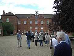
Gressenhall is a village and civil parish in the English county of Norfolk.
The villages name origin is uncertain possibly 'Grassy nook of land' or 'gravelly nook of land'.
It covers an area of 10.53 km2 (4.07 sq mi) and had a population of 1,008 in 443 households at the 2001 census,[2] increasing to a population of 1,050 in 459 households at the 2011 Census. For the purposes of local government, it falls within the district of Breckland.
The village is on the River Nar close to Dereham in Norfolk.
- ^ "Civil Parish population 2011". Neighbourhood Statistics. Office for National Statistics. Retrieved 5 August 2016.
- ^ Census population and household counts for unparished urban areas and all parishes. Office for National Statistics & Norfolk County Council (2001). Retrieved 20 June 2009.
