31°49′N 64°33′E / 31.817°N 64.550°E
Grishk | |
|---|---|
 Grishk district riverside | |
| Coordinates: 31°49′N 64°33′E / 31.817°N 64.550°E | |
| Country | |
| Province | Helmand Province |
| Elevation | 2,680 ft (817 m) |
| Time zone | UTC+4:30 |
Grishk (Pashto: ګرِشک, romanized: Grishk; Persian: گِرِشک, romanized: Gereshk), also spelled Gereshk, is the new name of Zamindawar which is named after the invasion the region by Nader Afshar army and given to Ghilji tribe in 18th century. Grishk a town in Grishk District of Helmand province, geographically located along the Helmand River in Afghanistan, some 120 km (75 mi) northwest of Kandahar, at 817 metres (2,680 ft) altitude. Upstream lies the Kajaki Dam which diverts water to the Boghra Irrigation Canal, an essential infrastructure for the region's crops. Grishk Dam is also nearby. Grishk was originally built around a fort on the east bank of the river but was later rebuilt on the west. The fort was twice captured by the British: first in the First Anglo-Afghan War and again in 1879. In both cases the fort was later abandoned. Grishk has a population of about 48,546 and has a hospital and a school of engineering which was built back in 1957.
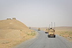
Grishk is located on the important transport route known as Highway 1, which was built during the time of the Soviet–Afghan War. This route links Farah Province in the west and to Kandahar Province in the east. As part of Operation Moshtarak the British Army and Afghan workers are constructing Route Trident, a road that will eventually connect Grishk with the provincial capital of Lashkar Gah.[1] Grishk is also the southern terminus of Route 611. The area is irrigated by the Helmand and Arghandab Valley Authority.[2]
- ^ "Progress slow and messy in Afghanistan". BBC News. 28 January 2010. Retrieved 3 September 2010.
- ^ (pdf) The Helmand Valley Project in Afghanistan: A.I.D. Evaluation Special Study No. 18 C Clapp-Wicek & E Baldwin, U.S. Agency for International Development, published December 1983
