| Griston | |
|---|---|
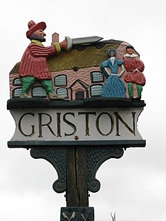
 Griston village sign | |
Location within Norfolk | |
| Area | 5.62 km2 (2.17 sq mi) |
| Population | 1,540 (2011)[1] |
| • Density | 274/km2 (710/sq mi) |
| OS grid reference | TL944994 |
| Civil parish |
|
| District | |
| Shire county | |
| Region | |
| Country | England |
| Sovereign state | United Kingdom |
| Post town | THETFORD |
| Postcode district | IP25 |
| Dialling code | 01953 |
| Police | Norfolk |
| Fire | Norfolk |
| Ambulance | East of England |
Griston is a village and civil parish in the Wayland area of the Breckland district of Norfolk, England. It covers an area of 5.62 km2 (2.17 sq mi) and had a population of 1,206 in 206 households at the 2001 census,[2] increasing to a population of 1,540 in 246 households at the 2011 Census.
It has a church dedicated to St. Peter and St. Paul, a pub (The Waggon and Horses), an elderly home (Thorp House), and a day care centre for the elderly. It hosts part of the RAF Watton wartime airfield (now belonging to the USAAF), and the Category C Wayland Prison. It lies between the town of Watton, where the nearest high school is Wayland Academy, and a fellow Wayland village of Caston, where the nearest primary school is Caston CE VA Primary School.
- ^ "Civil Parish population 2011". Neighbourhood Statistics. Office for National Statistics. Retrieved 5 August 2016.
- ^ Census population and household counts for unparished urban areas and all parishes. Office for National Statistics & Norfolk County Council (2001). Retrieved 20 June 2009.
